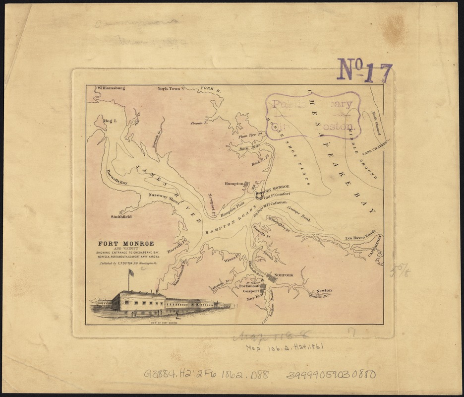
Fort Monroe and vicinity showing entrance to Chesapeake Bay, Norfolk, Portsmouth, Gosport Navy Yard &c
Item Information
- Title:
- Fort Monroe and vicinity showing entrance to Chesapeake Bay, Norfolk, Portsmouth, Gosport Navy Yard &c
- Creator:
- E.P. Dutton (Firm)
- Date:
-
[1862]
- Format:
-
Maps/Atlases
- Location:
-
Boston Public Library
Norman B. Leventhal Map Center - Collection (local):
-
Norman B. Leventhal Map Center Collection
- Subjects:
-
Harbors--Virginia--Fort Monroe--Maps
Fort Monroe (Va.)--Maps
Virginia--Maps
- Places:
-
Fortress Monroe (defense installation)
- Extent:
- 1 map : col., 15 x 18 cm.
- Terms of Use:
-
No known copyright restrictions.
No known restrictions on use.
- Scale:
-
Scale not given.
- Language:
-
English
- Notes:
-
Shows forts Monroe, Calhoun, Nelson, and Norfolk, Confederate batteries on Sewell's Point, towns, names of features.
Includes engraving: View of Fort Monroe.
This printing lacks roads.
Cf. LC Civil War Maps (2nd ed.), 546 for dif. printing.
- Notes (date):
-
This date is inferred.
- Identifier:
-
06_01_007388
- Call #:
-
G3884.H2:2F6 1862 .D88
- Barcode:
-
39999059030880


