Schonberg's Virginia campaign map, 1864
Item Information
- Title:
- Schonberg's Virginia campaign map, 1864
- Creator:
- Schönberg & Co
- Date:
-
1864
- Format:
-
Maps/Atlases
- Location:
-
Boston Public Library
Norman B. Leventhal Map Center - Collection (local):
-
Norman B. Leventhal Map Center Collection
- Subjects:
-
Virginia--History--Civil War, 1861-1865--Maps
- Places:
-
Virginia
- Extent:
- 1 map : col. ; 52 x 35 cm.
- Terms of Use:
-
No known copyright restrictions.
No known restrictions on use.
- Publisher:
-
New York :
Schönberg & Co.
- Scale:
-
Scale ca. 1:425,000.
- Language:
-
English
- Notes:
-
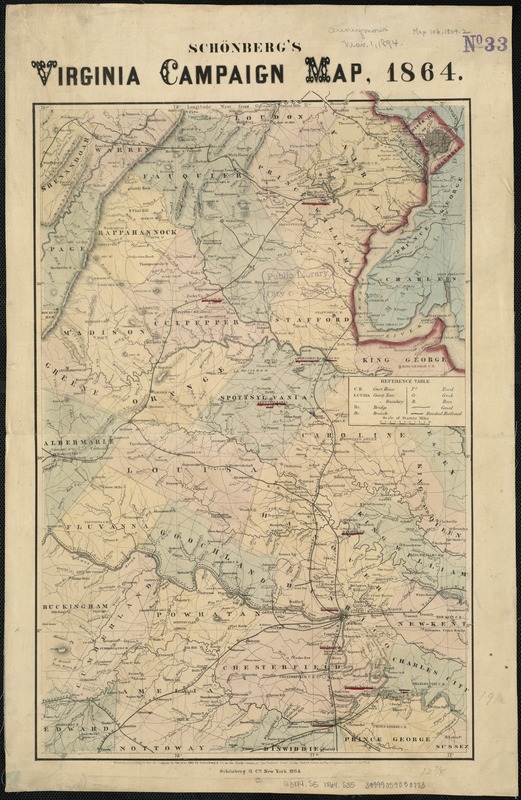
Map extends from Ashby's Gap south to Winfield and Charlottesville east to Tappahannock and shows the location and date of engagements, towns, roads, railroads, county names and boundaries, drainage, and some relief by hachures. A few place names are underlined in red.
Description derived from published bibliography.
- Identifier:
-
06_01_007378
- Call #:
-
G3884.S5 1864 .S35
- Barcode:
-
39999059030773
- LCCN:
-
99448876


