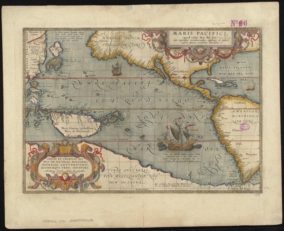
Maris Pacifici (quod vulgo Mar del Zur) cum regionibus circumiacentibus, insulisque in eodem passim sparsis, novissima descriptio
Item Information
- Title:
- Maris Pacifici (quod vulgo Mar del Zur) cum regionibus circumiacentibus, insulisque in eodem passim sparsis, novissima descriptio
- Creator:
- Ortelius, Abraham, 1527-1598
- Date:
-
[1612]
- Format:
-
Maps/Atlases
- Location:
-
Boston Public Library
Norman B. Leventhal Map Center - Collection (local):
-
Norman B. Leventhal Map Center Collection
- Subjects:
-
Pacific Ocean--Maps--Early works to 1800
Southeast Asia--Maps--Early works to 1800
Asia--Maps--Early works to 1800
Australia--Maps--Early works to 1800
America--Maps--Early works to 1800
New Guinea--Maps--Early works to 1800
1589
- Places:
-
Southeast Asia (area)
New Guinea (island)
Australia
Pacific Ocean
- Extent:
- 1 map : hand col. ; 34 x 49 cm.
- Terms of Use:
-
No known copyright restrictions.
No known restrictions on use.
- Publisher:
-
Anversa :
Libraria Plantiniana
- Scale:
-
Scale [ca. 1:42,000,000]
- Language:
-
Latin
Italian
- Notes:
-
Map of the Pacific Ocean showing part of south-east Asia, America, New Guinea and Terra Australis.
Plate 6 from: Theatro d'el orbe de la tierra / de Abrahamo Ortelio. In Anversa : Libraria Plantiniana, 1612.
Italian text on verso: Il Mare Pacifico overo del Svr.
Cartouche at bottom left of map: Genio et ingenio nobili dn. Nicolao Roccoxio, Patricio Antverpiensi, eiusdemque urbis Senatori / Abrahamus Ortelius, Regiae Mts. geographus lub. merito dedicabit, 1589.
Text on map in Latin. Text on verso in Italian.
Cataloging, conservation, and digitization made possible in part by The National Endowment for the Humanities: Exploring the human endeavor.
- Notes (date):
-
This date is inferred.
- Identifier:
-
06_01_007369
- Call #:
-
G9230 1612 .O78x
- Barcode:
-
39999059030682


![[Polus Antarcticus]](https://bpldcassets.blob.core.windows.net/derivatives/images/commonwealth:7h14b184w/image_thumbnail_300.jpg)

