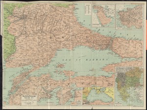
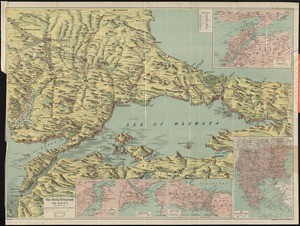
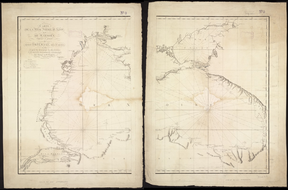
Carte de la mer noire, d'Azof et de Marmora : composée et gravée au dépôt impérial des cartes en 1804 d'après les descriptions les plus récentes et les nouvelles déterminations astronomiques des Russes et des François ; composé par A. Wilbrecht
Item Information
- Title:
- Carte de la mer noire, d'Azof et de Marmora : composée et gravée au dépôt impérial des cartes en 1804 d'après les descriptions les plus récentes et les nouvelles déterminations astronomiques des Russes et des François ; composé par A. Wilbrecht
- Creator:
- Wilbrecht, Alexander.
- Date:
-
1804
- Format:
-
Maps/Atlases
- Location:
-
Boston Public Library
Norman B. Leventhal Map Center - Collection (local):
-
Norman B. Leventhal Map Center Collection
- Subjects:
-
Black Sea--Maps
Black Sea Coast (Turkey)--Maps
Azov, Sea of (Ukraine and Russia)--Maps
Marmara, Sea of (Turkey)--Maps
- Places:
-
Black Sea
Sea of Azof
Marmara Denizi
- Extent:
- 1 map on 2 sheets ; 66 x 101 cm, sheets 80 x 60 cm.
- Terms of Use:
-
No known copyright restrictions.
No known restrictions on use.
- Publisher:
-
Saint-Petersbourg :
[s.n.]
- Scale:
-
Scale not given.
- Language:
-
French
- Notes:
-
Depths shown by soundings.
- Identifier:
-
06_01_007274
- Call #:
-
G7432.B5 1804 .W53x
- Barcode:
-
39999059030542