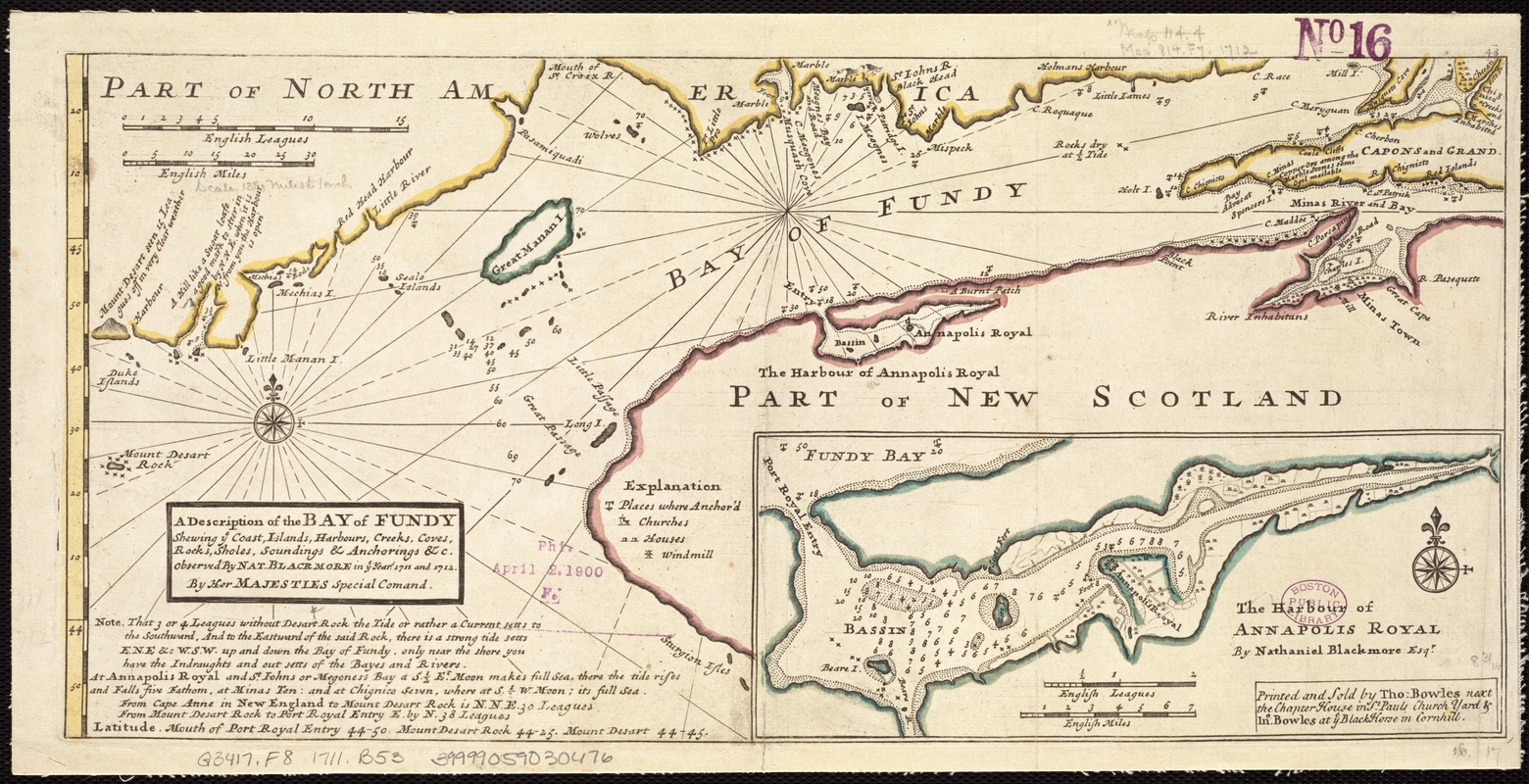
A description of the Bay of Fundy : shewing ye coast, islands, harbours, creeks, coves, rocks & sholes, soundings & anchorings &c
Item Information
- Title:
- A description of the Bay of Fundy : shewing ye coast, islands, harbours, creeks, coves, rocks & sholes, soundings & anchorings &c
- Creator:
- Blackmore, Nathaniel.
- Name on Item:
-
observed by Nat. Blackmore in ye year 1711 and 1712, by Her Majesties Special Command ; [drawn by H. Moll, Geographer].
- Date:
-
[1736]
- Format:
-
Maps/Atlases
- Location:
-
Boston Public Library
Norman B. Leventhal Map Center - Collection (local):
-
Norman B. Leventhal Map Center Collection
- Subjects:
-
Nautical charts--Fundy, Bay of--Early works to 1800
Nautical charts--Nova Scotia--Annapolis Basin--Early works to 1800
Fundy, Bay of--Maps--Early works to 1800
Annapolis Basin (N.S.)--Maps--Early works to 1800
- Places:
-
CanadaAnnapolis Basin (bay)
CanadaFundy, Bay of
- Extent:
- 1 map : col. ; 21 x 43 cm.
- Terms of Use:
-
No known copyright restrictions.
No known restrictions on use.
- Publisher:
-
[London] :
Printed and sold by Tho. Bowles & Jno. Bowles
- Scale:
-
Scale [ca. 1:960,000]
- Language:
-
English
- Notes:
-
Depths shown by soundings.
Inset map: The harbour of Annapolis Royal / by Nathaniel Blackmore, Esqr. Scale [ca. 1:210,000].
Appears in Herman Moll's Atlas minor. London: Thomas Bowles and John Bowles, [1736].
- Notes (date):
-
This date is inferred.
- Identifier:
-
06_01_007266
- Call #:
-
G3417.F8 1711 .B53
- Barcode:
-
39999059030476


