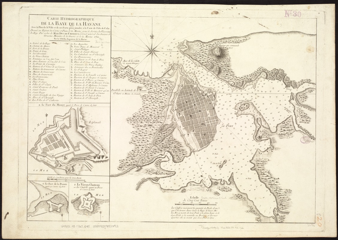
Carte hydrographique de la baye de la Havane : avec le plan de la ville et de ses forts pour joindre a la Carte de l'isle de Cube
This map is also available in American Revolutionary Geographies Online (ARGO), a collections portal especially built for material relating to the American Revolutionary War Era. Visit ARGO to learn more about this item and explore the historical geography of North America in the late eighteenth century.
Item Information
- Title:
- Carte hydrographique de la baye de la Havane : avec le plan de la ville et de ses forts pour joindre a la Carte de l'isle de Cube
- Creator:
- Bellin, Jacques Nicolas, 1703-1772
- Name on Item:
-
dressée au Dêpost des cartes et plans de la marine, pour le service des vaisseaux du roy ; par ordre de M. le duc de Choiseul, colonel général des suisses et grisons, ministre de la guerre et de la marine, 1762 ; par le S. Bellin, ingenieur de la marine.
- Date:
-
[1762?]
- Format:
-
Maps/Atlases
- Location:
-
Boston Public Library
Norman B. Leventhal Map Center - Collection (local):
-
Norman B. Leventhal Map Center Collection
- Subjects:
-
Nautical charts--Cuba--Havana Bay--Early works to 1800
Fortification--Cuba--Havana--Maps--Early works to 1800
Havana Bay (Cuba)--Maps--Early works to 1800
Havana (Cuba)--Buildings, structures, etc--Maps--Early works to 1800
Havana (Cuba)--Maps--Early works to 1800
- Places:
-
Havana (province)Havana
- Extent:
- 1 map ; 40 x 57 cm.
- Terms of Use:
-
No known copyright restrictions.
No known restrictions on use.
- Publisher:
-
Paris :
Dépost des cartes et plans de la marine
- Scale:
-
Scale [ca. 1:12,500].
- Language:
-
French
- Notes:
-
Relief shown by hachures. Soundings shown in feet.
Includes index and insets of "Le Fort du Maure," "Le Fort de la Pointe," and "Le Vieux Chateau."
- Identifier:
-
06_01_007268
- Call #:
-
G4922.H3 1762 .B45
- Barcode:
-
39999059030492


