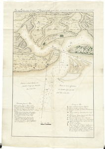
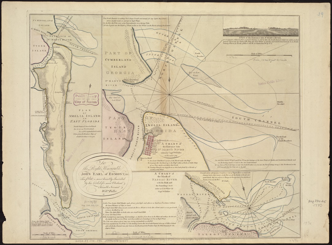
Plan of Amelia Island in East Florida : A chart of the entrance into St. Mary's River taken by Captn. W. Fuller in November, 1769 ; A chart of the mouth of Nassau River with the bar and the soundings on it taken at low water by Captn. W. Fuller
This map is also available in American Revolutionary Geographies Online (ARGO), a collections portal especially built for material relating to the American Revolutionary War Era. Visit ARGO to learn more about this item and explore the historical geography of North America in the late eighteenth century.
Item Information
- Title:
- Plan of Amelia Island in East Florida : A chart of the entrance into St. Mary's River taken by Captn. W. Fuller in November, 1769 ; A chart of the mouth of Nassau River with the bar and the soundings on it taken at low water by Captn. W. Fuller
- Title (alt.):
-
Chart of the entrance into St. Mary's River taken by Captn. W. Fuller in November, 1769
Chart of the mouth of Nassau River with the bar and the soundings on it taken at low water by Captn. W. Fuller
- Creator:
- Fuller, William.
- Date:
-
1770
- Format:
-
Maps/Atlases
- Location:
-
Boston Public Library
Norman B. Leventhal Map Center - Collection (local):
-
Norman B. Leventhal Map Center Collection
- Subjects:
-
Amelia Island (Fla.)--Maps--Early works to 1800
Saint Marys River (Ga. and Fla.)--Maps--Early works to 1800
Nassau River (Fla.)--Maps--Early works to 1800
- Places:
-
Nassau (county)Little Saint Marys River
Nassau River
- Extent:
- 3 maps on 1 sheet ; 51 x 16 cm., 36 x 45 cm. and 16 x 45 cm., on sheet 56 x 74 cm.
- Terms of Use:
-
No known copyright restrictions.
No known restrictions on use.
- Publisher:
-
[London] :
Thomas Jefferys
- Scale:
-
Scale [ca. 1:65,000].
Scale [ca. 1:22,000].
Scale [ca. 1:33,000].
- Language:
-
English
- Notes:
-
Relief shown by hachures and pictorially. Depths shown by soundings.
"This plate is ... inscribed by ... Willm. Fuller."
Includes A view of the entrance into St. Mary's River.
Dedication in cartouche.
- Identifier:
-
06_01_007254
- Call #:
-
G3932.A4 1770 .F85
- Barcode:
-
39999059030377