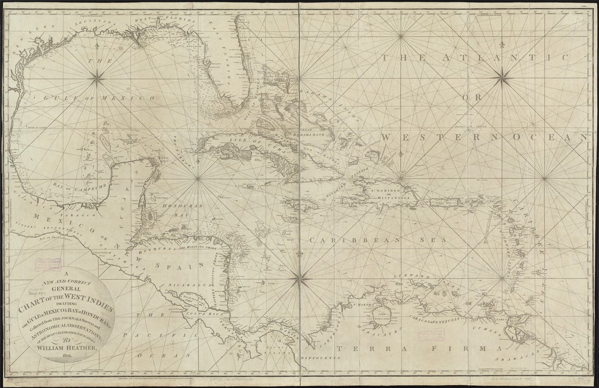
A new and correct general chart of the West Indies including the Gulf of Mexico & Bay of Honduras &c : collected from the journals surveys and astronomical observations of the most celebrated navigators
Item Information
- Title:
- A new and correct general chart of the West Indies including the Gulf of Mexico & Bay of Honduras &c : collected from the journals surveys and astronomical observations of the most celebrated navigators
- Creator:
- Heather, William, 1764-1812
- Name on Item:
-
by William Heather.
- Date:
-
1801
- Format:
-
Maps/Atlases
- Location:
-
Boston Public Library
Norman B. Leventhal Map Center - Collection (local):
-
Norman B. Leventhal Map Center Collection
- Subjects:
-
Nautical charts--West Indies
West Indies--Maps
Mexico, Gulf of--Maps
- Places:
-
West Indies
Mexico, Gulf of
- Extent:
- 1 chart ; 77 x 123 cm.
- Terms of Use:
-
No known copyright restrictions.
No known restrictions on use.
- Publisher:
-
London :
William Heather
- Scale:
-
Scale ca. 1:3,900,000.
- Language:
-
English
- Notes:
-
Depths shown by soundings.
Cataloging, conservation, and digitization made possible in part by The National Endowment for the Humanities: Exploring the human endeavor.
- Identifier:
-
06_01_007244
- Call #:
-
G4900 1801 .H43x
- Barcode:
-
39999059030286