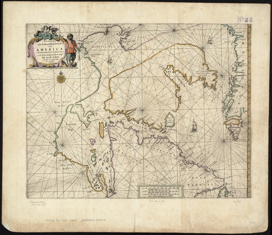
Paskaert van de Noordelijckste kuste van America van Groenland door de Straet Davis en de Straet Hudson tot Terra Neuf
Item Information
- Title:
- Paskaert van de Noordelijckste kuste van America van Groenland door de Straet Davis en de Straet Hudson tot Terra Neuf
- Creator:
- Colom, Jacob Aertsz, 1599-1673
- Name on Item:
-
bij Iacob Colom.
- Date:
-
[1669]
- Format:
-
Maps/Atlases
- Location:
-
Boston Public Library
Norman B. Leventhal Map Center - Collection (local):
-
Norman B. Leventhal Map Center Collection
- Subjects:
-
Coasts--Maritime Provinces--Maps--Early works to 1800
Coasts--North Atlantic Region--Maps--Early works to 1800
Coasts--Greenland--Maps--Early works to 1800
Maritime Provinces--Maps--Early works to 1800
North Atlantic Region--Maps--Early works to 1800
Greenland--Maps--Early works to 1800
- Places:
-
Greenland (territory)
CanadaProvince of Prince Edward Island (province)
- Extent:
- 1 map : col. ; 42 x 53 cm.
- Terms of Use:
-
No known copyright restrictions.
No known restrictions on use.
- Publisher:
-
Amsterdam :
J. Colom
- Scale:
-
Scale 1:8,000,000.
- Language:
-
Dutch
- Notes:
-
Map of the coast of northern Labrador and Quebec, and the west coast of Greenland.
Appears in the author's Atlas Maritimo. Amsterdam, 1669.
Cataloging, conservation, and digitization made possible in part by The National Endowment for the Humanities: Exploring the human endeavor.
- Notes (date):
-
This date is inferred.
- Identifier:
-
06_01_007232
- Call #:
-
G3412.C6 1668 .C65x
- Barcode:
-
39999059030252