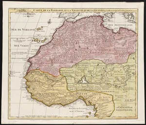
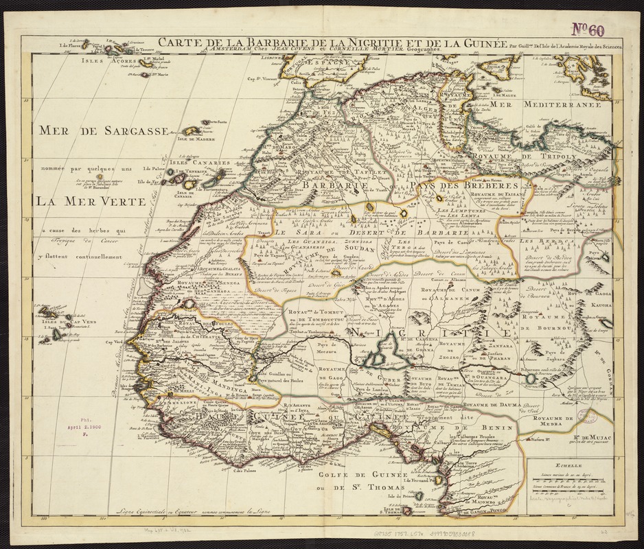
Carte de la Barbarie de la Nigritie et de la Guinée
Item Information
- Title:
- Carte de la Barbarie de la Nigritie et de la Guinée
- Creator:
- L'Isle, Guillaume de, 1675-1726
- Name on Item:
-
par Guill.me Del'Isle de l'Academie Royale des Sciences.
- Date:
-
[1757]
- Format:
-
Maps/Atlases
- Location:
-
Boston Public Library
Norman B. Leventhal Map Center - Collection (local):
-
Norman B. Leventhal Map Center Collection
- Subjects:
-
Africa, West--Maps--Early works to 1800
- Places:
-
West Africa (area)
- Extent:
- 1 map : col. ; 49 x 60 cm.
- Terms of Use:
-
No known copyright restrictions.
No known restrictions on use.
- Publisher:
-
A Amsterdam :
chez Jean Covens et Corneille Mortier
- Scale:
-
Scale [ca. 1:9,000,000].
- Language:
-
French
- Notes:
-
Relief shown pictorially.
Appears in the author's Atlas Nouveau. Amsterdam : Jean Covens & Corneille Mortier, [1757].
- Notes (date):
-
This date is inferred.
- Identifier:
-
06_01_007174
- Call #:
-
G8735 1757 .L57x
- Barcode:
-
39999059030088