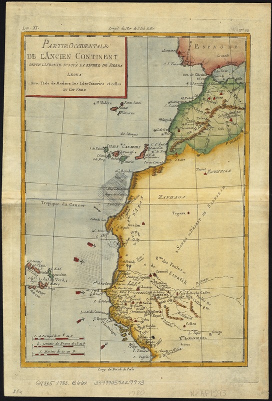
Partie occidentale de l'ancien continent depuis Lisbonne jusquà la Riviere de Sierra Leona : avec l'Isle Madere, les Isles Canaires, et celles du C. Verd
Item Information
- Title:
- Partie occidentale de l'ancien continent depuis Lisbonne jusquà la Riviere de Sierra Leona : avec l'Isle Madere, les Isles Canaires, et celles du C. Verd
- Creator:
- Bonne, Rigobert, 1727-1794
- Date:
-
[1783–1784]
- Format:
-
Maps/Atlases
- Location:
-
Boston Public Library
Norman B. Leventhal Map Center - Collection (local):
-
Norman B. Leventhal Map Center Collection
- Subjects:
-
Africa, West--Maps
- Places:
-
West Africa (area)
- Extent:
- 1 map : col. ; 31 x 21 cm.
- Terms of Use:
-
No known copyright restrictions.
No known restrictions on use.
- Publisher:
-
Neuchatel ; Geneve :
Chez les Libraries Associés
- Scale:
-
Scale [ca. 1:11,500,000].
- Language:
-
French
- Notes:
-
Relief shown pictorially.
Imprint derived from atlas in which map appears.
Appears in Guillaume Raynal's Atlas de toutes les parties connues du Globe Terrestre. Neuchatel & Geneve: Chez les Libraries Associés, 1783-1784.
"Liv. XI" upper left corner. "No. 43" upper right corner.
- Notes (date):
-
This date is inferred.
- Identifier:
-
06_01_007149
- Call #:
-
G8735 1783 .B66x
- Barcode:
-
39999059029973