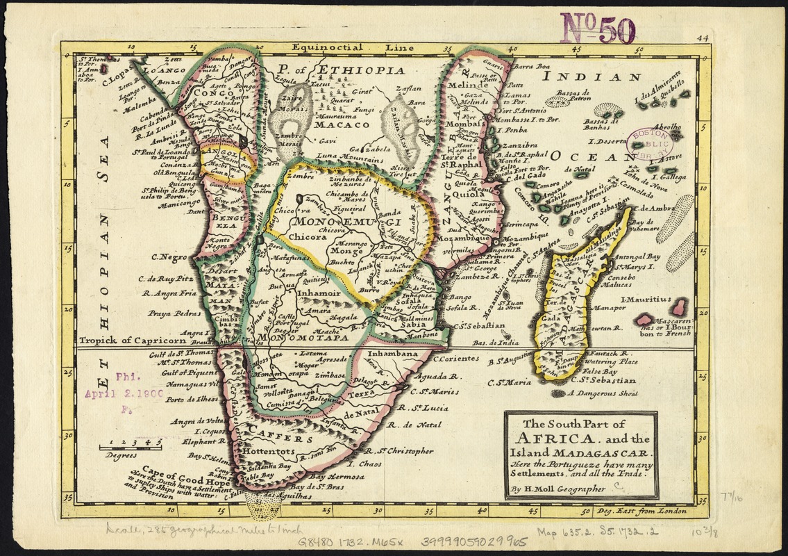
The south part of Africa, and the island of Madagascar : here the Portugueze have many settlements and all the trade
Item Information
- Title:
- The south part of Africa, and the island of Madagascar : here the Portugueze have many settlements and all the trade
- Creator:
- Moll, Herman, d. 1732
- Publisher:
- Bowles, John, 1701-1779
- Publisher:
- Bowles, Thomas, 1694-1773
- Name on Item:
-
by H. Moll ...
- Date:
-
[1732–1736]
- Format:
-
Maps/Atlases
- Location:
-
Boston Public Library
Norman B. Leventhal Map Center - Collection (local):
-
Norman B. Leventhal Map Center Collection
- Subjects:
-
Africa, Southern--Maps--Early works to 1800
Madagascar--Maps--Early works to 1800
- Places:
-
Southern Africa (area)
Madagascar
- Extent:
- 1 map : col. ; 21 x 27 cm.
- Terms of Use:
-
No known copyright restrictions.
No known restrictions on use.
- Publisher:
-
London :
Printed for Tho. Bowles and John Bowles
- Scale:
-
Scale [1:20,000,000].
- Language:
-
English
- Notes:
-
Relief shown pictorially.
Numbered 44.
London meridian.
Appears in the author's Atlas minor. London: Printed for Tho. Bowles and John Bowles, 1732? or 1736?.
Africa, south of the Equator, with Madagascar.
- Notes (date):
-
This date is inferred.
- Identifier:
-
06_01_007147
- Call #:
-
G8480 1732 .M65x
- Barcode:
-
39999059029965