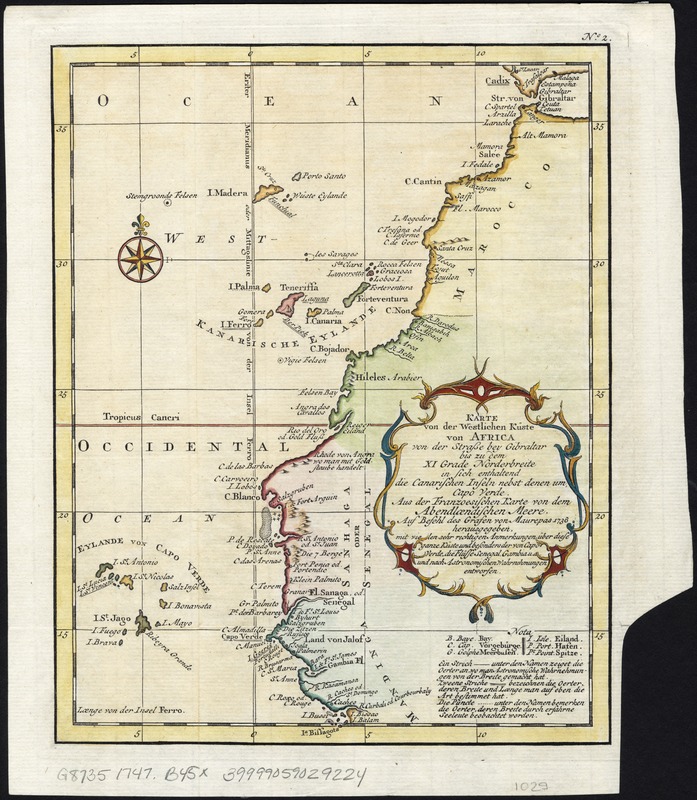
Karte von der westlichen kuste von Africa : von der strasse bey Gibraltar bis zu dem XI grade norderbreite ...wahrnehmungen entworfen
Item Information
- Title:
- Karte von der westlichen kuste von Africa : von der strasse bey Gibraltar bis zu dem XI grade norderbreite ...wahrnehmungen entworfen
- Creator:
- Bellin, Jacques Nicolas, 1703-1772
- Date:
-
[1747–1774]
- Format:
-
Maps/Atlases
- Location:
-
Boston Public Library
Norman B. Leventhal Map Center - Collection (local):
-
Norman B. Leventhal Map Center Collection
- Subjects:
-
Africa, West--Maps--Early works to 1800
- Places:
-
West Africa (area)
- Extent:
- 1 map : col. ; 23 x 18 cm.
- Terms of Use:
-
No known copyright restrictions.
No known restrictions on use.
- Publisher:
-
Leipzig :
Bey Arkstee und Merkus
- Scale:
-
Scale not given.
- Language:
-
German
- Notes:
-
Relief shown pictorially.
No. 2.
Appears in the author's Allgemeine Historie der Reisen zu Wasser und Lande. Leipzig: Bey Arkstee und Merkus, 1747-1774.
- Notes (date):
-
This date is inferred.
- Identifier:
-
06_01_007141
- Call #:
-
G8735 1747 .B45x
- Barcode:
-
39999059029924