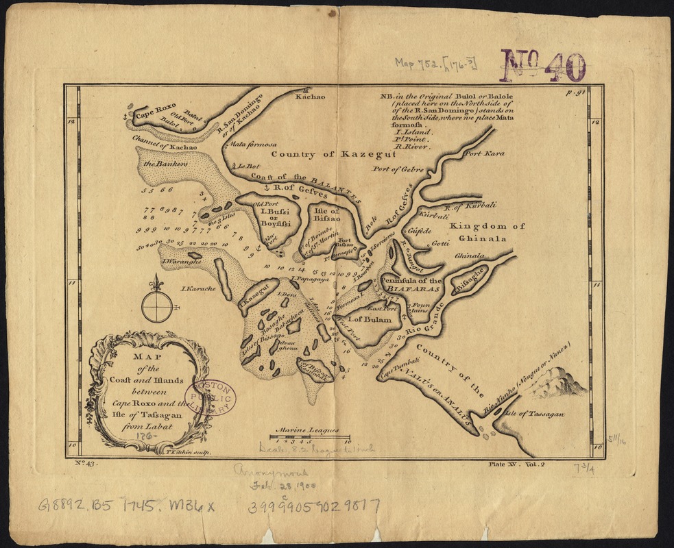
Map of the coast and islands between Cape Roxo and the Isle of Tassagan
Item Information
- Title:
- Map of the coast and islands between Cape Roxo and the Isle of Tassagan
- Name on Item:
-
from Labat.
- Date:
-
[1745?–1747?]
- Format:
-
Maps/Atlases
- Location:
-
Boston Public Library
Norman B. Leventhal Map Center - Collection (local):
-
Norman B. Leventhal Map Center Collection
- Subjects:
-
Guinea-Bissau--Maps--Early works to 1800
Bijagos Archipelago (Guinea-Bissau)--Maps--Early works to 1800
- Places:
-
Guinea-Bissau
Guinea-BissauBijagós, Arquipélago dos (area)
- Extent:
- 1 map ; 15 x 20 cm.
- Terms of Use:
-
No known copyright restrictions.
No known restrictions on use.
- Publisher:
-
London :
s.n.
- Scale:
-
Scale [ca. 1:1,750,000].
- Language:
-
English
- Notes:
-
Relief shown pictorially.
Lower left : T. Kitchin sculp.
Numbered No. 43, Plate XV, Vol. 2.
Upper right corner: p. 91.
Appears in John Green's A new general collection of voyages and travels; consisting of the most esteemed relations ... London: Printed for Thomas Astley, 1745-1747.
- Identifier:
-
06_01_007122
- Call #:
-
G8737.C6 1745 .M36x
- Barcode:
-
39999059029817


