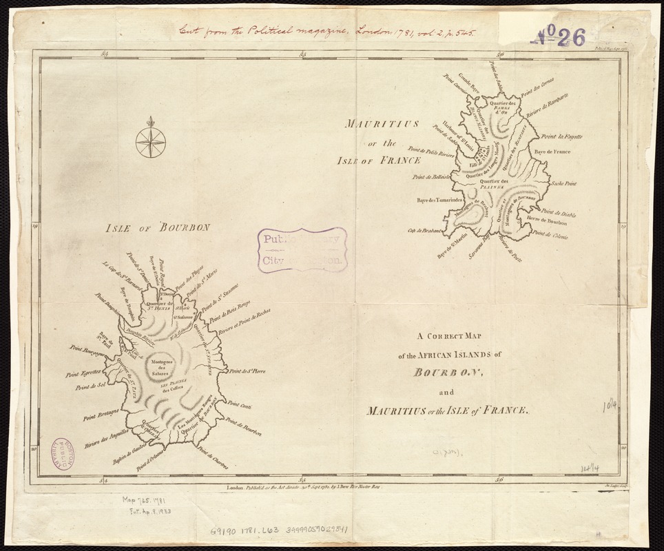
A correct map of the African islands of Bourbon, and Mauritius or the Isle of France
Item Information
- Title:
- A correct map of the African islands of Bourbon, and Mauritius or the Isle of France
- Creator:
- Lodge, John, d. 1796
- Name on Item:
-
Jn. Lodge sculp.
- Date:
-
1781
- Format:
-
Maps/Atlases
- Location:
-
Boston Public Library
Norman B. Leventhal Map Center - Collection (local):
-
Norman B. Leventhal Map Center Collection
- Subjects:
-
Mauritius--Maps--Early works to 1800
Réunion--Maps--Early works to 1800
- Places:
-
Mauritius
Reunion (territory)
- Extent:
- 1 map ; 26 x 37 cm.
- Terms of Use:
-
No known copyright restrictions.
No known restrictions on use.
- Publisher:
-
London :
J. Bew
- Scale:
-
Scale [ca. 1:887,040]
- Language:
-
English
- Notes:
-
Relief shown by hachures.
Appears in the Political Magazine. London: J. Bew, September 1781, v.2.
- Identifier:
-
06_01_007129
- Call #:
-
G9190 1781 .L63
- Barcode:
-
39999059029841


