A chart of the coast of Barbaria with the western, Canaria, & Cape de Verd, isles
Item Information
- Title:
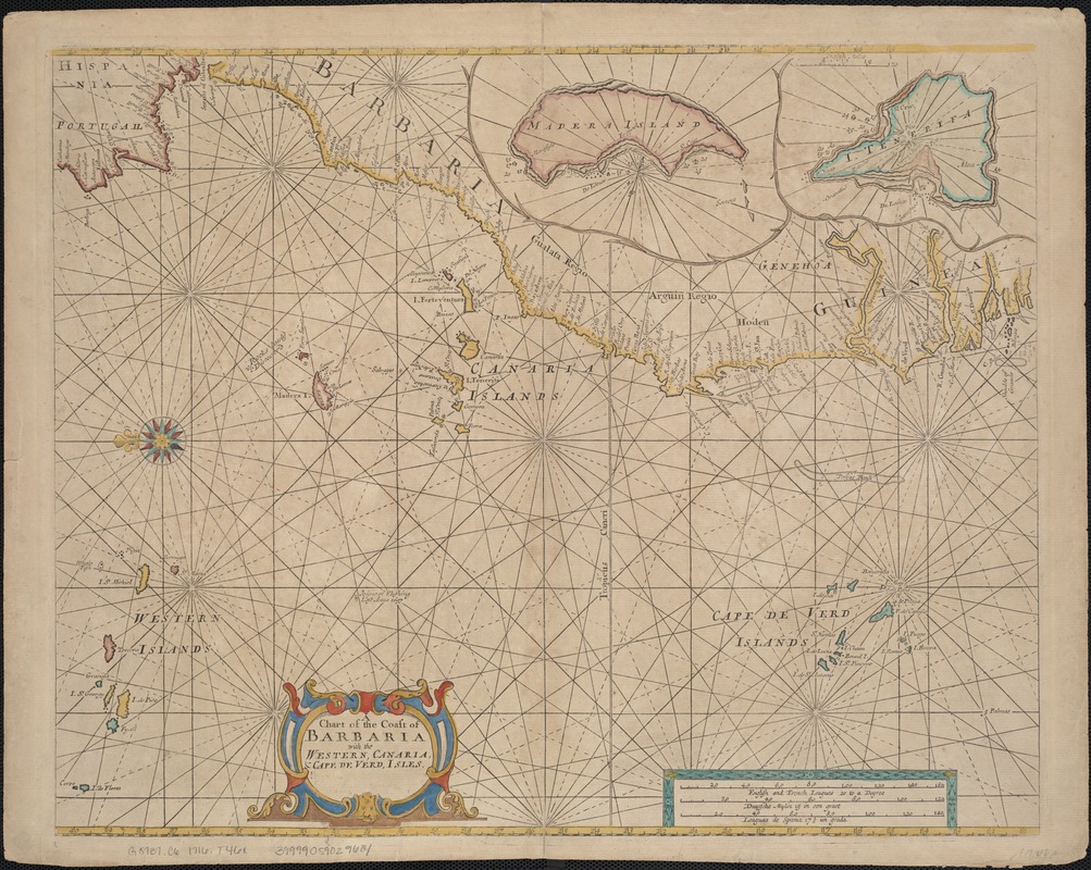
- A chart of the coast of Barbaria with the western, Canaria, & Cape de Verd, isles
- Creator:
- Thornton, John, 1641-1708
- Date:
-
[1716?]
- Format:
-
Maps/Atlases
- Location:
-
Boston Public Library
Norman B. Leventhal Map Center - Collection (local):
-
Norman B. Leventhal Map Center Collection
- Subjects:
-
Nautical charts--Early works to 1800
Africa, West--Maps--Early works to 1800
Atlantic Coast (Africa)--Maps--Early works to 1800
Canary Islands--Maps--Early works to 1800
Cape Verde--Maps--Early works to 1800
- Places:
-
West Africa (area)
Cape Verde
Canary Islands (island)
- Extent:
- 1 chart : col. ; 42 x 54 cm.
- Terms of Use:
-
No known copyright restrictions.
No known restrictions on use.
- Publisher:
-
London :
for R. & W. Mount & T. Page
- Scale:
-
Scale ca. 1:6,000,000.
- Language:
-
English
- Notes:
-
Nautical chart.
Imprint derived from published bibliography.
Oriented with north to the left.
Appears in the author's ed. of the English Pilot, the Third book. London: for R. & W. Mount & T. Page, 1716.
- Identifier:
-
06_01_007109
- Call #:
-
G8737.C6 1716 .T46x
- Barcode:
-
39999059029684