Carta Del Littorale Di Napoli e de luoghi antichi più rimarchevoli di quei Contorni
Item Information
- Title:
- Carta Del Littorale Di Napoli e de luoghi antichi più rimarchevoli di quei Contorni
- Description:
-
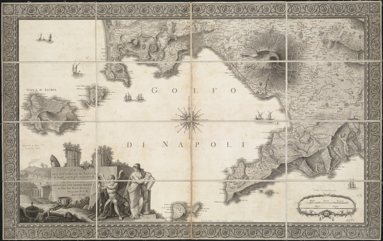
Volcanoes have appeared on maps since the 15th century; however, the true makeup of these fascinating and devastating landforms was not fully appreciated until the 20th century. For many years and in numerous cultures, volcanoes were understood and explained as part of a mythology, as seen in this 1794 map illustrating the seismically-active land around Naples, Italy, where Mount Vesuvius features prominently. Vesuvius violently erupted in 79 CE, burying Pompeii and surrounding towns in up to 23 feet of ash, rock and volcanic debris. The cartouche in the lower-left corner of the map illustrates the volcano, along with the classical figures Thanatos, representing Death, and Clio, signifying personal character, presiding over Pompeii’s ruins.
- Creator:
- Rizzi-Zannoni, Giovanni Antonio, 1736-1814
- Name on Item:
-
delineata per ordine del Re da Gio. Ant. Rizzi-Zanoni ; Gius. Gerra Nap. Reg. Inc.
- Date:
-
1794
- Format:
-
Maps/Atlases
- Location:
-
Boston Public Library
Norman B. Leventhal Map Center - Collection (local):
-
Norman B. Leventhal Map Center Collection
- Subjects:
-
Naples (Italy)--Maps--Early works to 1800
- Places:
-
Koni (region)Napoli (province)Naples
- Extent:
- 1 map ; 45 x 76 cm.
- Terms of Use:
-
No known copyright restrictions.
No known restrictions on use.
- Publisher:
-
S.l :
[s.n.]
- Scale:
-
Scale ca. 1:114,000.
- Language:
-
Italian
- Notes:
-
Relief shown by hachures.
Decorative border and engraving around title.
- Notes (exhibitions):
-
Exhibited: "Beneath Our Feet: Mapping the World Below" organized by the Norman B. Leventhal Map Center at the Boston Public Library, 2017-2018.
- Identifier:
-
06_01_007094
- Call #:
-
G6713.N32 1794 .R69x
- Barcode:
-
39999059029544


