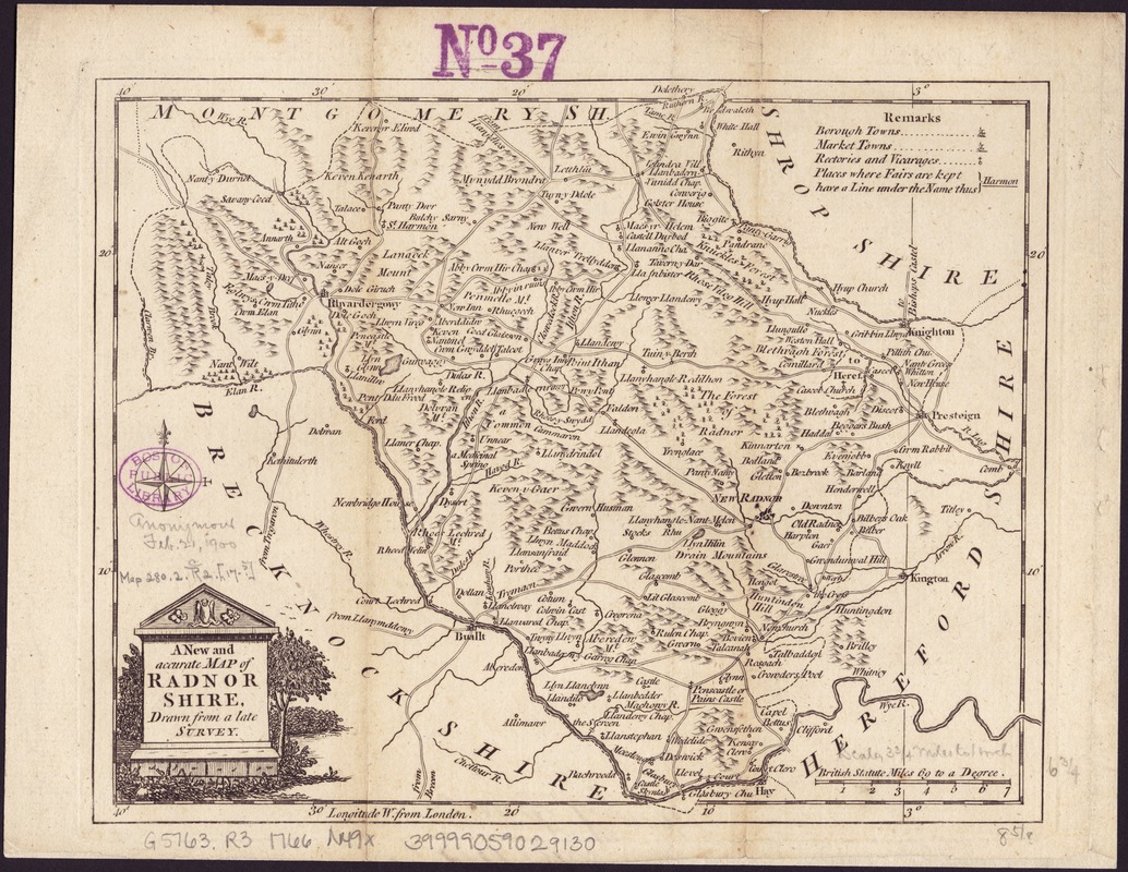
A New and accurate map of Radnor Shire
Item Information
- Title:
- A New and accurate map of Radnor Shire
- Name on Item:
-
drawn from a late survey.
- Date:
-
[1766]
- Format:
-
Maps/Atlases
- Location:
-
Boston Public Library
Norman B. Leventhal Map Center - Collection (local):
-
Norman B. Leventhal Map Center Collection
- Subjects:
-
Radnorshire (Wales)--Maps--Early works to 1800
- Places:
-
WalesRadnor (area)
- Extent:
- 1 map ; 19 x 23 cm.
- Terms of Use:
-
No known copyright restrictions.
No known restrictions on use.
- Publisher:
-
London :
John Hinton
- Scale:
-
Scale ca. 1:237,600.
- Language:
-
English
- Notes:
-
Relief shown pictorially.
Imprint from published bibliography.
- Notes (date):
-
This date is inferred.
- Identifier:
-
06_01_006993
- Call #:
-
G5763.R3 1766 .N49x
- Barcode:
-
39999059029130


