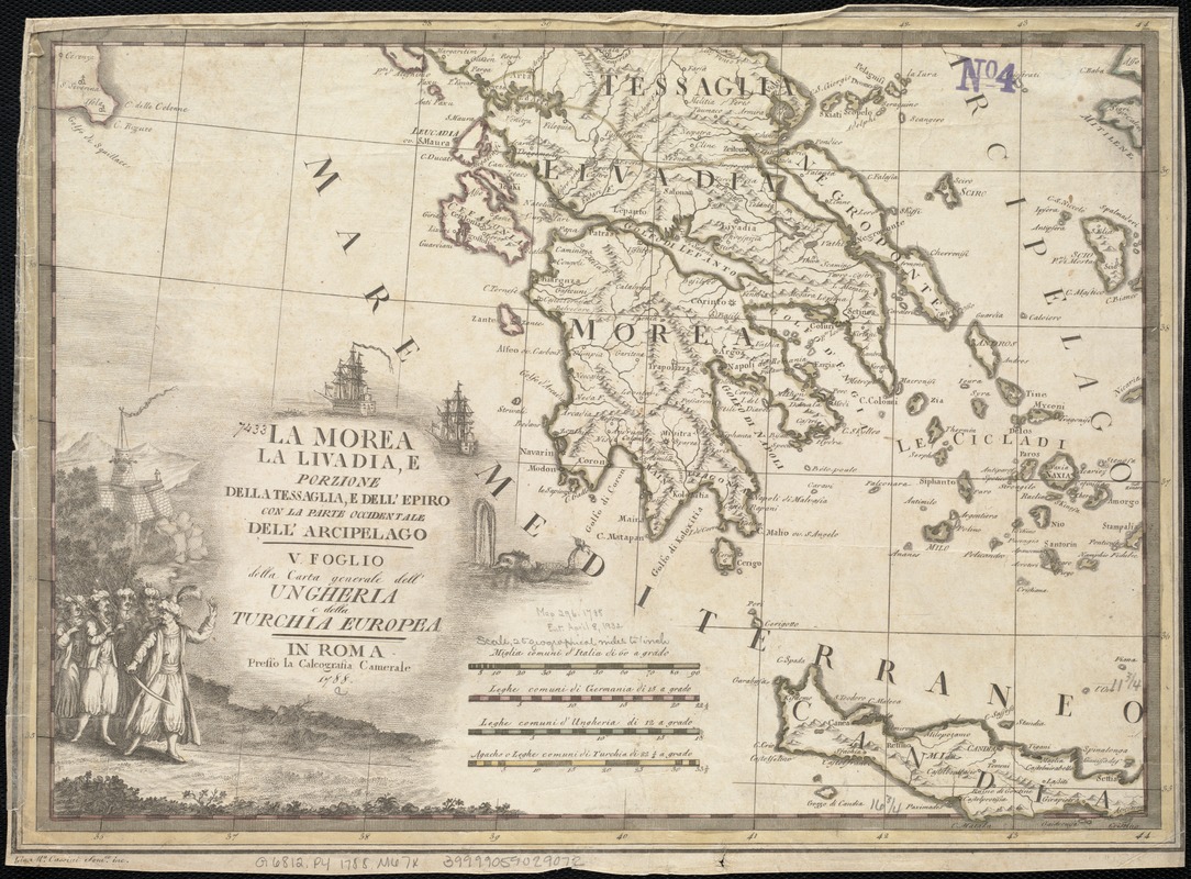
La Morea, la Livadia, e porzione della Tessaglia, e Dell' Epiro con la parte occidentale dell' arcipelago : V. Foglio della carta generale dell' Ungheria e della Turchia Europea
Item Information
- Title:
- La Morea, la Livadia, e porzione della Tessaglia, e Dell' Epiro con la parte occidentale dell' arcipelago : V. Foglio della carta generale dell' Ungheria e della Turchia Europea
- Name on Item:
-
Gio. M.a Cassini Som.co inc.
- Date:
-
1788
- Format:
-
Maps/Atlases
- Location:
-
Boston Public Library
Norman B. Leventhal Map Center - Collection (local):
-
Norman B. Leventhal Map Center Collection
- Subjects:
-
Peloponnesus (Greece : Peninsula)--Maps--Early works to 1800
- Places:
-
Peloponnese (region)
- Extent:
- 1 map : col. ; 31 x 43 cm.
- Terms of Use:
-
No known copyright restrictions.
No known restrictions on use.
- Publisher:
-
Roma :
Presso la Calcografia Camerale
- Scale:
-
Scale ca. 1:1,584,000.
- Language:
-
Italian
- Notes:
-
Relief shown pictorially.
- Identifier:
-
06_01_007009
- Call #:
-
G6812.P4 1788 .M67x
- Barcode:
-
39999059029072