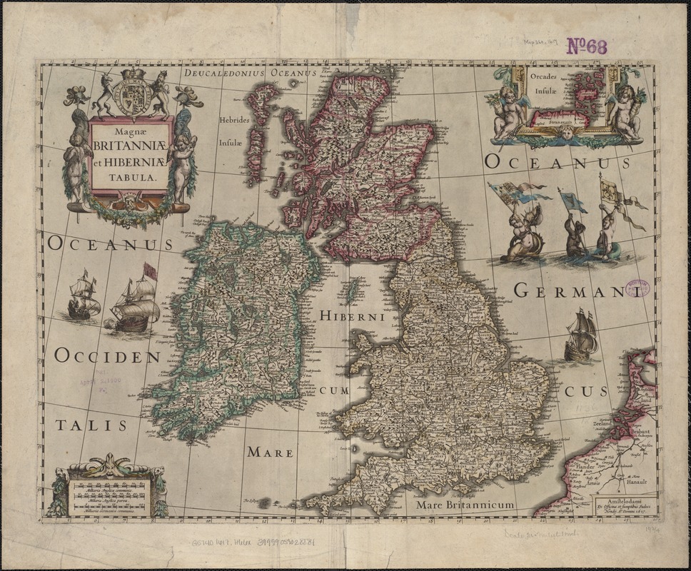
Magnae Britanniae et Hiberniae Tabula
Item Information
- Title:
- Magnae Britanniae et Hiberniae Tabula
- Creator:
- Hondius, Jodocus, 1594 or 5-1629
- Date:
-
[1617]
- Format:
-
Maps/Atlases
- Location:
-
Boston Public Library
Norman B. Leventhal Map Center - Collection (local):
-
Norman B. Leventhal Map Center Collection
- Subjects:
-
British Isles--Maps--Early works to 1800
Ireland--Maps--Early works to 1800
- Places:
-
British Isles (area)
Ireland
- Extent:
- 1 map : outline col. ; 37 x 51 cm.
- Terms of Use:
-
No known copyright restrictions.
No known restrictions on use.
- Publisher:
-
Amstelodami :
Ex Officina et Sumptibus Judoci Hondij
- Scale:
-
Scale ca. 1:2,300,000.
- Language:
-
Latin
- Notes:
-
Relief shown pictorially.
Inset: Orcades Insulae.
- Notes (date):
-
This date is inferred.
- Identifier:
-
06_01_006967
- Call #:
-
G5740 1617 .H66x
- Barcode:
-
39999059028884