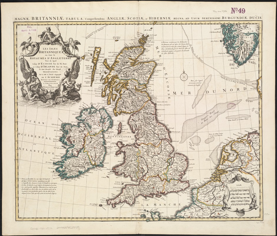
Les Isles Britanniques ou sont le royaumes d'Angleterre
Item Information
- Title:
- Les Isles Britanniques ou sont le royaumes d'Angleterre
- Title (alt.):
-
Magnae Britanniae tabula, comprehendens Angliae, Scotiae ac Hiberniae regna, ad usum serenissimi Burgundiae ducis
- Creator:
- L'Isle, Guillaume de, 1675-1726
- Name on Item:
-
tiré de Sped, celuy d'Ecosse tiré de Th. Pont et celuy d'Irlande tiré de Petti ; le tout rectifié par diverses observations par G. de l'Isle ...
- Date:
-
[1730]
- Format:
-
Maps/Atlases
- Location:
-
Boston Public Library
Norman B. Leventhal Map Center - Collection (local):
-
Norman B. Leventhal Map Center Collection
- Subjects:
-
British Isles--Maps--Early works to 1800
- Places:
-
British Isles (area)
- Extent:
- 1 map : outline col. ; 47 x 57 cm.
- Terms of Use:
-
No known copyright restrictions.
No known restrictions on use.
- Publisher:
-
A Amsteldam :
chez I. Cóvens & C. Mortier
- Scale:
-
Scale ca. 1:2,534,400.
- Language:
-
French
Latin
- Notes:
-
Relief shown pictorially.
Title in margin: Magnae Britanniae tabula, comprehendens Angliae, Scotiae ac Hiberniae regna ...
Appears in the author's Atlas nouveau. Amsterdam : Jean Covens & Corneille Mortier, [ca. 1757].
- Notes (date):
-
This date is inferred.
- Identifier:
-
06_01_006963
- Call #:
-
G5740 1730 .L57x
- Barcode:
-
39999059028850