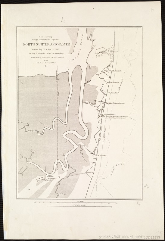
Map showing siege operations against Forts Sumter and Wagner between July 13th & Sept. 7th, 1863
Item Information
- Title:
- Map showing siege operations against Forts Sumter and Wagner between July 13th & Sept. 7th, 1863
- Creator:
- Brooks, T. B. (Thomas Benton), 1836-1900
- Name on Item:
-
By Maj. T.B. Brooks, A.D.C. & assist. engrs.
- Date:
-
[1863]
- Format:
-
Maps/Atlases
- Location:
-
Boston Public Library
Norman B. Leventhal Map Center - Collection (local):
-
Norman B. Leventhal Map Center Collection
- Subjects:
-
Fortification--South Carolina--Civil War, 1861-1865--Maps
Fort Sumter (Charleston, S.C.)--History--19th century--Maps
Fort Wagner (S.C.)--History--19th century--Maps
- Places:
-
Charleston (county)Sullivan's Island (island)Fort Sumter National Monument
- Extent:
- 1 map ; 40 x 30 cm.
- Terms of Use:
-
No known copyright restrictions.
No known restrictions on use.
- Publisher:
-
[Washington, D.C.] :
Published by permission of Gen'l Gillmore at the U.S. Coast Survey Office
- Scale:
-
Scale: [ca. 1:6,750]
- Language:
-
English
- Notes:
-
Shows drainage, roads, high and low water line, 6-ft. and 12-ft. depth curve, batteries, trenches, stockades, and a plan of Fort Wagner.
Fort Sumter does not appear on this map, only the line of the fire to the fort from the breahing batteries south of Fort Wagner.
- Notes (date):
-
This date is inferred.
- Identifier:
-
06_01_006858
- Call #:
-
G3914.C3:2F6S5 1863 .B7
- Barcode:
-
39999059028777


