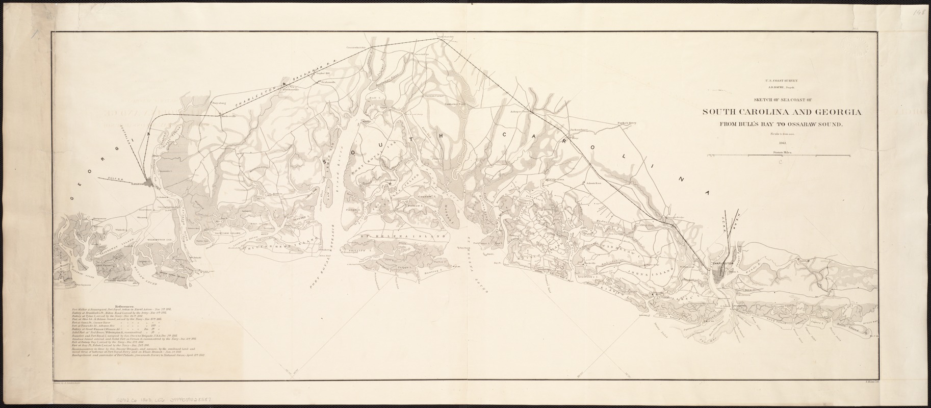
Sketch of sea coast of South Carolina and Georgia from Bull's Bay to Ossabaw Sound
Item Information
- Title:
- Sketch of sea coast of South Carolina and Georgia from Bull's Bay to Ossabaw Sound
- Creator:
- Lindenkohl, A.
- Name on Item:
-
drawn by A. Lindenkohl ; E. Molitor, lith.
- Date:
-
1863
- Format:
-
Maps/Atlases
- Location:
-
Boston Public Library
Norman B. Leventhal Map Center - Collection (local):
-
Norman B. Leventhal Map Center Collection
- Subjects:
-
Coasts--South Carolina--Maps
Coasts--Georgia--Maps
South Carolina--History--Civil War, 1861-1865--Maps
Georgia--History--Civil War, 1861-1865--Maps
- Places:
-
Georgia
South Carolina
- Extent:
- 1 map ; 39 x 87 cm.
- Terms of Use:
-
No known copyright restrictions.
No known restrictions on use.
- Publisher:
-
[S.l.] :
U.S. Coast Survey
- Scale:
-
Scale 1:200,000.
- Language:
-
English
- Notes:
-
Includes list of "References" to Civil War engagements.
- Identifier:
-
06_01_006841
- Call #:
-
G3912.C6 1863 .L56
- Barcode:
-
39999059028587