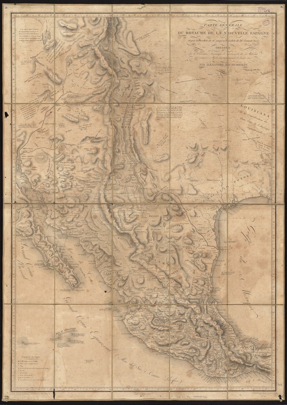
Carte générale du royaume de la Nouvelle Espagne depuis le parallèle de 16° jusqu'au parallèle de 38° (latitude nord)
Item Information
- Title:
- Carte générale du royaume de la Nouvelle Espagne depuis le parallèle de 16° jusqu'au parallèle de 38° (latitude nord)
- Creator:
- Humboldt, Alexander von, 1769-1859
- Name on Item:
-
dressé sur les observations astronomiques et sur l'ensemble des matériaux qui existaient à Mexico au commencement de l'année de 1804 par Alexandre de Humboldt ; perfectionné par le même et par MM. Friesen, Oltmanns et Thuilier en 1809.
- Date:
-
1809
- Format:
-
Maps/Atlases
- Location:
-
Boston Public Library
Norman B. Leventhal Map Center - Collection (local):
-
Norman B. Leventhal Map Center Collection
- Subjects:
-
Mexico--Maps
- Places:
-
Mexico
- Extent:
- 1 map ; 99 x 69 cm.
- Terms of Use:
-
No known copyright restrictions.
No known restrictions on use.
- Publisher:
-
Paris :
Barrière
- Scale:
-
Scale ca. 1:3,400,000.
- Language:
-
French
- Notes:
-
Relief shown by hachures.
Cataloging, conservation, and digitization made possible in part by The National Endowment for the Humanities: Exploring the human endeavor.
- Identifier:
-
06_01_006784
- Call #:
-
G4410 1809 .H86x
- Barcode:
-
39999059028116