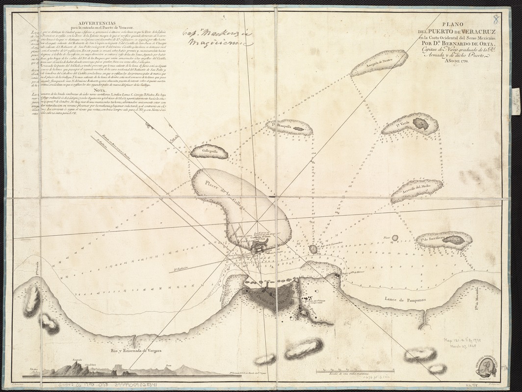
Plano del Puerto de Veracruz en la costa occidental del Seno Mexicano
This map is also available in American Revolutionary Geographies Online (ARGO), a collections portal especially built for material relating to the American Revolutionary War Era. Visit ARGO to learn more about this item and explore the historical geography of North America in the late eighteenth century.
Item Information
- Title:
- Plano del Puerto de Veracruz en la costa occidental del Seno Mexicano
- Creator:
- Orta, Bernardo de.
- Name on Item:
-
por Dn. Bernardo de Orta ; F. Bauzá fecit ; F. Selma inct.
- Date:
-
1798
- Format:
-
Maps/Atlases
- Location:
-
Boston Public Library
Norman B. Leventhal Map Center - Collection (local):
-
Norman B. Leventhal Map Center Collection
- Subjects:
-
Coasts--Mexico-Veracruz (Veracruz-Llave)--Maps--Early works to 1800
Veracruz (Veracruz-Llave, Mexico)--Maps--Early works to 1800
- Places:
-
VeracruzVeracruz
- Extent:
- 1 map ; 44 x 58 cm.
- Terms of Use:
-
No known copyright restrictions.
No known restrictions on use.
- Publisher:
-
[Madrid] :
Depósito Hidrográfico
- Scale:
-
Scale ca. 1:20,000.
- Language:
-
Spanish
- Notes:
-
Relief shown by hachures. Depths shown by soundings.
Includes a warning for entering the Port, notes, and a view of relief.
- Identifier:
-
06_01_006777
- Call #:
-
G4542.C6 1798 .O78
- Barcode:
-
39999059028041