Eldridge's map of Martha's Vineyard
Item Information
- Title:
- Eldridge's map of Martha's Vineyard
- Description:
-
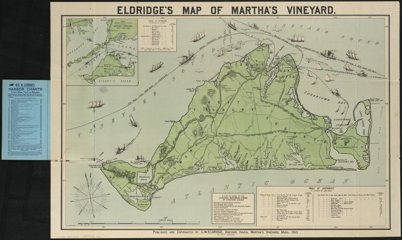
The Trustees have six reservations totaling more than 1,800 acres on the islands of Martha's Vineyard and Chappaquiddick. Cape Poge Wildlife Refuge, Wasque and Mytoi are found on the Vineyard's easternmost region – Chappaquiddick Island – while Norton Point Beach, Long Point Wildlife Refuge and Menemsha Hills are located on the main island. This 1913 tourist map of Martha's Vineyard depicts the diverse landscapes, made up of woodlands, hills, marshes, beaches and gardens. Some of the map's locations are easily recognizable by name, as they are based on natural features or original Native American titles.
- Creator:
- Eldridge, George, d. 1900
- Date:
-
1913
- Format:
-
Maps/Atlases
- Location:
-
Boston Public Library
Norman B. Leventhal Map Center - Collection (local):
-
Norman B. Leventhal Map Center Collection
- Subjects:
-
Martha's Vineyard (Mass.)--Maps
- Places:
-
Dukes (county)Martha's Vineyard (island)
- Extent:
- 1 map : col. ; 53 x 80 cm.
- Terms of Use:
-
No known copyright restrictions.
No known restrictions on use.
- Publisher:
-
Vineyard Haven, Mass :
G.W. Eldridge
- Scale:
-
Scale [1:42,240]
- Language:
-
English
- Notes:
-
Includes tables of distances and list of some of the leading business firms.
Inset: plan showing relative position of Martha's Vineyard with mainland; scale not given.
- Notes (exhibitions):
-
Exhibited: "From the Sea to the Mountains: The Trustees 125th Anniversary" organized by the Norman B. Leventhal Map Center at the Boston Public Library, 2016.
- Identifier:
-
06_01_006599
- Call #:
-
G3762.M3 1913 .E43
- Barcode:
-
39999059026946


