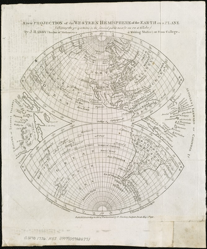
A new projection of the Western Hemisphere of the Earth on a plane : shewing the proportions of its several parts nearly as on a globe
Item Information
- Title:
- A new projection of the Western Hemisphere of the Earth on a plane : shewing the proportions of its several parts nearly as on a globe
- Creator:
- Hardy, J. (John), teacher at Eton College
- Name on Item:
-
by J. Hardy ; T. Bowen, delin. et sculpsit.
- Date:
-
1776
- Format:
-
Maps/Atlases
- Location:
-
Boston Public Library
Norman B. Leventhal Map Center - Collection (local):
-
Norman B. Leventhal Map Center Collection
- Subjects:
-
Western Hemisphere--Maps--Early works to 1800
- Places:
-
North and Central America
South America
Mesoamerica (area)
North America (area)
South America
America
- Extent:
- 1 map ; 23 cm. diam., on sheet 27 x 24 cm.
- Terms of Use:
-
No known copyright restrictions.
No known restrictions on use.
- Publisher:
-
[London] :
F. Newbery
- Scale:
-
Scale [ca. 1:100,000,000]
- Language:
-
English
- Notes:
-
Insets: Bahama or Lucayos Islands -- Antilles Leeward or Caribee Is.
From The gentleman's magazine, volume 46 issue 4, April 1776.
- Identifier:
-
06_01_006577
- Call #:
-
G3290 1776 .H37
- Barcode:
-
39999059026771


