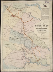
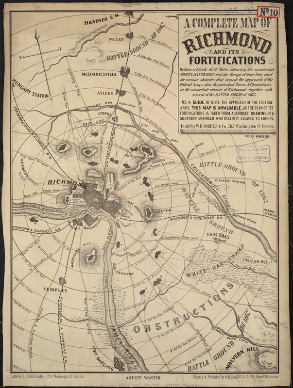
A complete map of Richmond and its fortifications within a circle of 12 miles showing the numerous forts, batteries and the range of their fire : and the various obstacles that impede the approach of the Federal army, also, the principal towns & plantations, in the immediate vicinity of Richmond, together with several of the battle fields of 1862
Item Information
- Title:
- A complete map of Richmond and its fortifications within a circle of 12 miles showing the numerous forts, batteries and the range of their fire : and the various obstacles that impede the approach of the Federal army, also, the principal towns & plantations, in the immediate vicinity of Richmond, together with several of the battle fields of 1862
- Description:
-
One of the geographic strategies for both armies was the capture of the other's capital. Washington, DC, was situated precariously on the Potomac River, sandwiched between Maryland, a slave state which did not secede, and Virginia, one of the last slave states to secede. As a primary defense, Union troops constructed an extensive ring of earthen forts around the city. Richmond, which became the Confederate capital in mid-1861, was situated less than 100 miles south of Washington, DC. Confederate troops also fortified Richmond with a ring of forts, as depicted on this map published in Boston. As a reminder to a northern audience that Richmond was the target, the publisher placed a series of concentric rings around the city.
- Creator:
- William H. Forbes & Company
- Date:
-
[1863]
- Format:
-
Maps/Atlases
- Location:
-
Boston Public Library
Norman B. Leventhal Map Center - Collection (local):
-
Norman B. Leventhal Map Center Collection
- Subjects:
-
Fortification--Virginia--Richmond--Maps
Richmond (Va.)--History--Civil War, 1861-1865--Maps
- Places:
-
Richmond
- Extent:
- 1 map ; 60 x 45 cm.
- Terms of Use:
-
No known copyright restrictions.
No known restrictions on use.
- Publisher:
-
Boston :
W.H. Forbes & Co.
- Scale:
-
Scale ca. 1:54,000.
- Language:
-
English
- Notes:
-
Relief shown by hachures.
Shows radial distances in mile increments from the city of Richmond.
"As a guide to note the approach of the Federal army, this map is invaluable, as the plan of its fortifications is taken from a correct drawing of a Southern engineer, who recently escaped to Europe."
Description derived from published bibliography.
- Notes (date):
-
This date is inferred.
- Notes (exhibitions):
-
Exhibited: "Torn in Two: The 150th Anniversary of the Civil War" organized by the Norman B. Leventhal Map Center at the Boston Public Library, 2011.
- Identifier:
-
06_01_006570
- Call #:
-
G3884.R5S5 1863 .W55
- Barcode:
-
39999059026631
- LCCN:
-
99439218