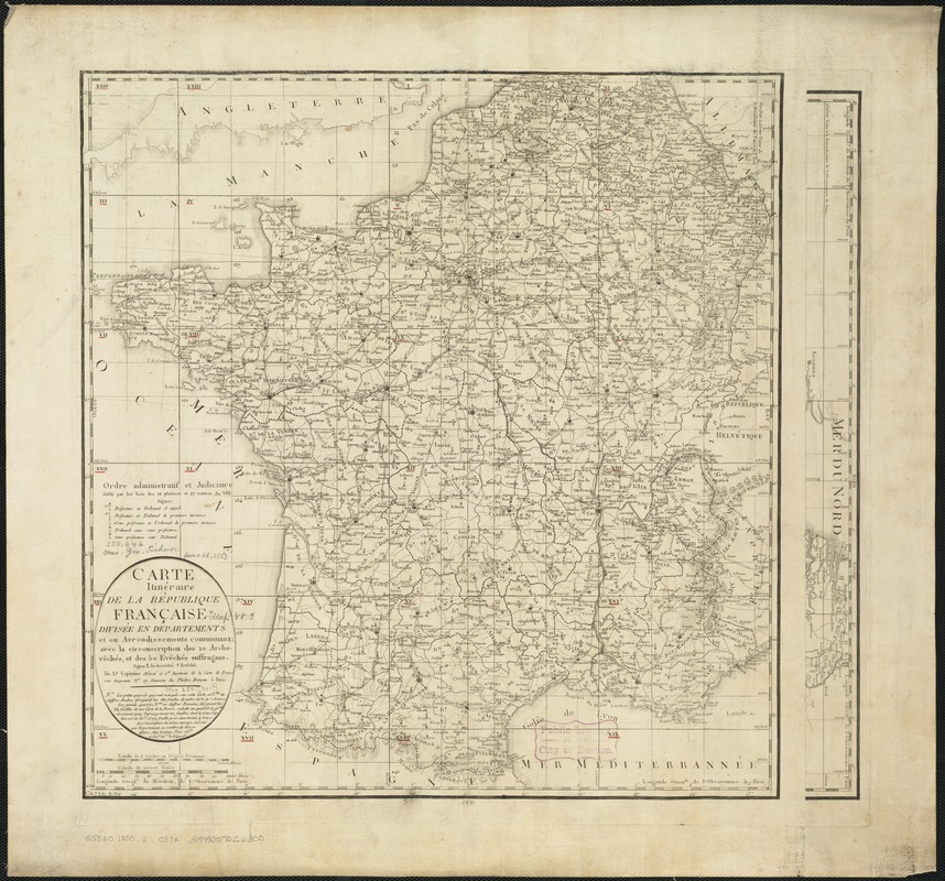
Carte itinéraire de la Républic Française divisée en departments et en arrondissements communaux : avec la circonscription des 10 archevêchés, et des 50 evêchés suffragans
Item Information
- Title:
- Carte itinéraire de la Républic Française divisée en departments et en arrondissements communaux : avec la circonscription des 10 archevêchés, et des 50 evêchés suffragans
- Creator:
- Capitaine, Louis, ca. 1749-ca. 1797
- Name on Item:
-
par Ls. Capitaine.
- Date:
-
[1800?]
- Format:
-
Maps/Atlases
- Location:
-
Boston Public Library
Norman B. Leventhal Map Center - Collection (local):
-
Norman B. Leventhal Map Center Collection
- Subjects:
-
France--Administrative and political divisions--Maps
- Places:
-
France
- Extent:
- 1 map ; 49 x 51 cm, on sheet 59 x 63 cm.
- Terms of Use:
-
No known copyright restrictions.
No known restrictions on use.
- Publisher:
-
Paris :
[s.n.]
- Scale:
-
Scale ca. 2,100,000.
- Language:
-
French
- Notes:
-
Relief shown by hachures.
Map of the French Republic divided into departments and districts, with the municipal districts of the 10 archbishops and 50 diocesan bishops.
- Identifier:
-
06_01_006523
- Call #:
-
G5830 1800.2 .C37x
- Barcode:
-
39999059026300