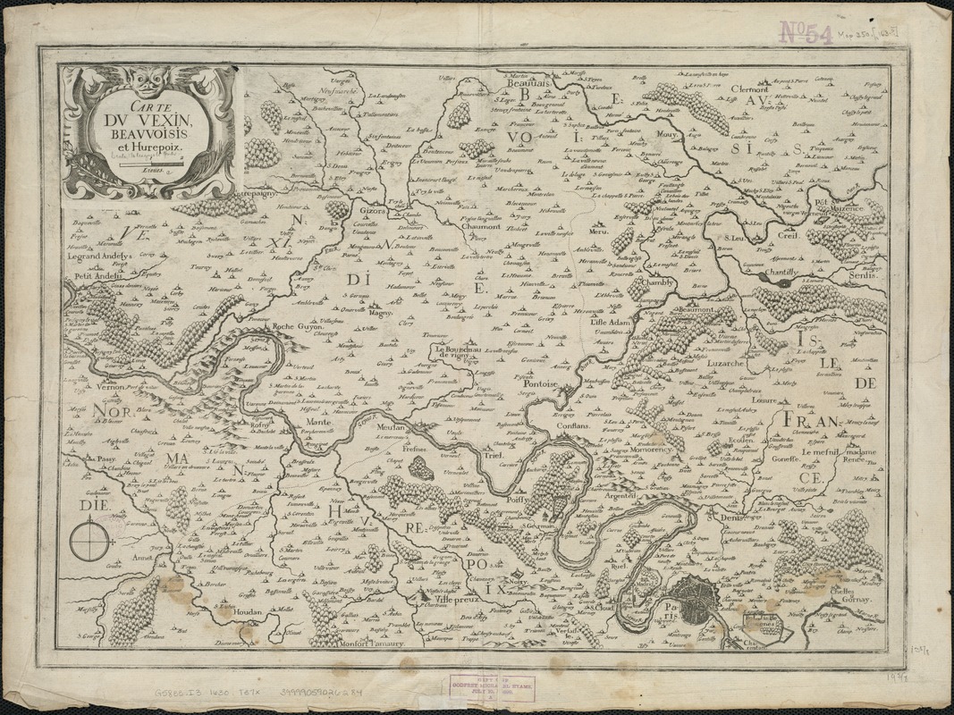
Carte du Vexin, Beauvoisis, et Hurepoix
Item Information
- Title:
- Carte du Vexin, Beauvoisis, et Hurepoix
- Title (alt.):
-
Carte dv Vexin, Beavvoisis, et Hurepoix
- Creator:
- Tassin, Christophe Nicolas, d. 1660
- Date:
-
[1634?–1650?]
- Format:
-
Maps/Atlases
- Location:
-
Boston Public Library
Norman B. Leventhal Map Center - Collection (local):
-
Norman B. Leventhal Map Center Collection
- Subjects:
-
Vexin (France)--Maps--Early works to 1800
Beauvaisis (France)--Maps--Early works to 1800
Hurepoix (France)--Maps--Early works to 1800
Picardy (France)--Maps--Early works to 1800
Normandy (France)--Maps--Early works to 1800
- Places:
-
FrancePicardy (former primary political entity)
FranceVexin (area)
- Extent:
- 1 map ; 35 x 49 cm.
- Terms of Use:
-
No known copyright restrictions.
No known restrictions on use.
- Publisher:
-
S.l :
s.n.
- Scale:
-
Scale ca. 1:240,000.
- Language:
-
French
- Notes:
-
Relief shown pictorially.
Map of the historic areas of Vexin, Beauvoisis and Hurepoix along the River Seine in France.
Authorship based on article in Map Forum. Vol. 1, issue 2.
- Identifier:
-
06_01_006519
- Call #:
-
G5833.I3 1630 .T37x
- Barcode:
-
39999059026284