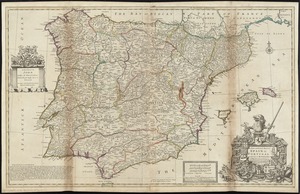
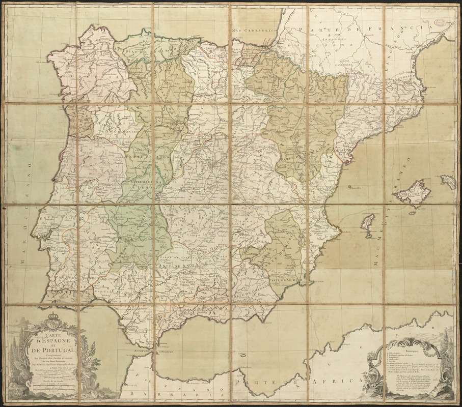
Carte d'Espagne et de Portugal, comprenant les routes de poste et autres de ces deux roiaumes
Item Information
- Title:
- Carte d'Espagne et de Portugal, comprenant les routes de poste et autres de ces deux roiaumes
- Creator:
- Brion de la Tour, Louis, d. 1823
- Name on Item:
-
par M. Brion.
- Date:
-
[1788?]
- Format:
-
Maps/Atlases
- Location:
-
Boston Public Library
Norman B. Leventhal Map Center - Collection (local):
-
Norman B. Leventhal Map Center Collection
- Subjects:
-
Iberian Peninsula--Maps--Early works to 1800
Spain--Maps--Early works to 1800
Portugal--Maps--Early works to 1800
- Places:
-
Iberian Peninsula (area)
Spain
Portugal
- Extent:
- 1 map : col. ; 75 x 85 cm.
- Terms of Use:
-
No known copyright restrictions.
No known restrictions on use.
- Publisher:
-
A Paris :
Chez le Sr. Desnos
- Scale:
-
Scale ca. 1:1,230,000.
- Language:
-
French
- Notes:
-
Relief shown pictorially.
- Identifier:
-
06_01_006496
- Call #:
-
G6540 1788 .B75x
- Barcode:
-
39999059026110
![[Hispania]](https://bpldcassets.blob.core.windows.net/derivatives/images/commonwealth:7h14b057s/image_thumbnail_300.jpg)