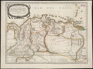
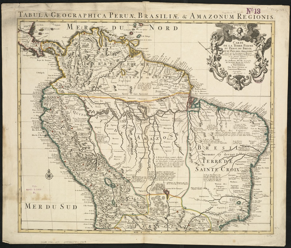
Carte de la Terre Ferme, du Perou, du Bresil et du Pays des Amazones : dressée sur les descriptions de Herrera, de Laet, et des PP. Acuña, et M. Rodriguez et sur plusieurs relations et observations posterieures
Item Information
- Title:
- Carte de la Terre Ferme, du Perou, du Bresil et du Pays des Amazones : dressée sur les descriptions de Herrera, de Laet, et des PP. Acuña, et M. Rodriguez et sur plusieurs relations et observations posterieures
- Title (alt.):
-
Tabula geographica Peruæ, Brasiliæ & Amazonum Regionis
- Creator:
- L'Isle, Guillaume de, 1675-1726
- Name on Item:
-
par Guillaume Del'Isle.
- Date:
-
[1730?]
- Format:
-
Maps/Atlases
- Location:
-
Boston Public Library
Norman B. Leventhal Map Center - Collection (local):
-
Norman B. Leventhal Map Center Collection
- Subjects:
-
South America--Maps--Early works to 1800
Brazil--Maps--Early works to 1800
Peru--Maps--Early works to 1800
Colombia--Maps--Early works to 1800
Venezuela--Maps--Early works to 1800
Guiana--Maps--Early works to 1800
Ecuador--Maps--Early works to 1800
- Places:
-
Peru
Guiana (area)
Brazil
South America
Colombia
Ecuador
Venezuela
South America
- Extent:
- 1 map ; 47 x 56 cm.
- Terms of Use:
-
No known copyright restrictions.
No known restrictions on use.
- Publisher:
-
Amsterdam :
Chez Jean Covens et Corneille Mortier
- Scale:
-
Scale [ca. 1:9,000,000].
- Language:
-
French
- Notes:
-
Relief shown pictorially.
"Avec privil."
Outline color.
Shows modern day Brazil, Peru, Ecuador, Colombia, Venezuela and Guiana.
- Identifier:
-
06_01_006470
- Call #:
-
G5200 1730 .L57
- Barcode:
-
39999059025849