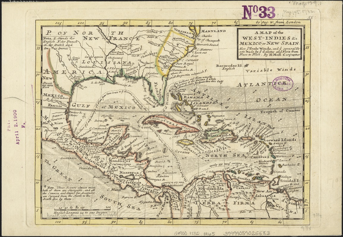
A map of the West-Indies &c. Mexico or New Spain : also ye trade winds, and ye several tracts made by ye galeons and flota from place to place
Item Information
- Title:
- A map of the West-Indies &c. Mexico or New Spain : also ye trade winds, and ye several tracts made by ye galeons and flota from place to place
- Creator:
- Moll, Herman, d. 1732
- Publisher:
- Bowles, John, 1701-1779
- Publisher:
- Bowles, Thomas, 1694-1773
- Name on Item:
-
by H. Moll.
- Date:
-
[1732?]
- Format:
-
Maps/Atlases
- Location:
-
Boston Public Library
Norman B. Leventhal Map Center - Collection (local):
-
Norman B. Leventhal Map Center Collection
- Subjects:
-
West Indies--Maps--Early works to 1800
Mexico--Maps--Early works to 1800
Caribbean Area--Maps--Early works to 1800
- Places:
-
Mexico
West Indies
Caribbean Sea
- Extent:
- 1 map : col. ; 19 x 26 cm.
- Terms of Use:
-
No known copyright restrictions.
No known restrictions on use.
- Publisher:
-
London :
Printed for Tho. Bowles and John Bowles
- Scale:
-
Scale [1:18,000,000].
- Language:
-
English
- Notes:
-
Imprint derived from the atlas in which the map was issued.
Numbered 55.
Trade winds shown by shading and arrows.
Shows boundaries, rivers and settlements.
Relief shown pictorially.
London meridian.
Appears in the author's Atlas minor. London: Thomas Bowles and John Bowles, 1732 or 1736.
Gulf of Mexico and the Caribbean.
Cataloging, conservation, and digitization made possible in part by The National Endowment for the Humanities: Exploring the human endeavor.
- Identifier:
-
06_01_006429
- Call #:
-
G4900 1732 .M65
- Barcode:
-
39999059025583


