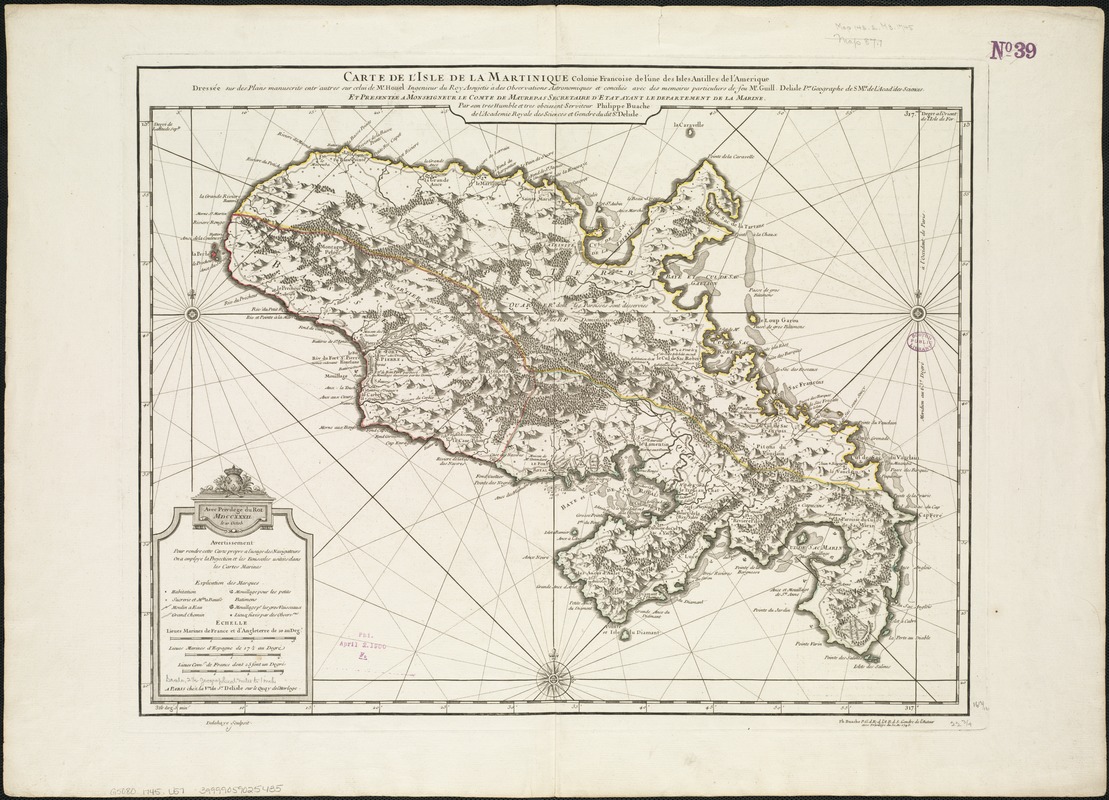
Carte de l'isle de la Martinique colonie Françoise de l'une des isles Antilles de l'Amérique
Item Information
- Title:
- Carte de l'isle de la Martinique colonie Françoise de l'une des isles Antilles de l'Amérique
- Creator:
- L'Isle, Guillaume de, 1675-1726
- Name on Item:
-
dressée sur des plans manuscrits entr' autres sur celui de Mr. Houel ingénieur du roy assujetis à des observations astronomiques et conciliés avec des mémoires partiiculiers de feu Mr. Guill. Delisle per. géographe de S. Mte. de l'Acad. des Sciences ; et presentée à Monseigneur le Comte de Maurepas secretaire d'état ayant le départment de la Marine ; par ... Philippe Buache.
- Date:
-
1745
- Format:
-
Maps/Atlases
- Location:
-
Boston Public Library
Norman B. Leventhal Map Center - Collection (local):
-
Norman B. Leventhal Map Center Collection
- Subjects:
-
Martinique--Maps--Early works to 1800
- Places:
-
Martinique (territory)
- Extent:
- 1 map : outline col. ; 43 x 58 cm.
- Terms of Use:
-
No known copyright restrictions.
No known restrictions on use.
- Publisher:
-
[Paris] :
Ph. Buache P.G. d. R. d. l'A.R. d. S. gendre de l'auteur
- Scale:
-
Scale ca. 1:183,333.
- Language:
-
French
- Notes:
-
Relief shown by hachures.
Earlier publication information in separate cartouche: A Paris: Chez la Vve. du Sr. Delisle sur le Quay de l'Horloge, avec privlége de roi MDCCXXXII le 10 Octob.
Engraved by: Delahaye.
Key of references identifies houses, mills, anchorages, and other features.
Cataloging, conservation, and digitization made possible in part by The National Endowment for the Humanities: Exploring the human endeavor.
- Identifier:
-
06_01_006405
- Call #:
-
G5080 1745 .L57
- Barcode:
-
39999059025435