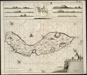
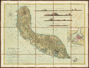
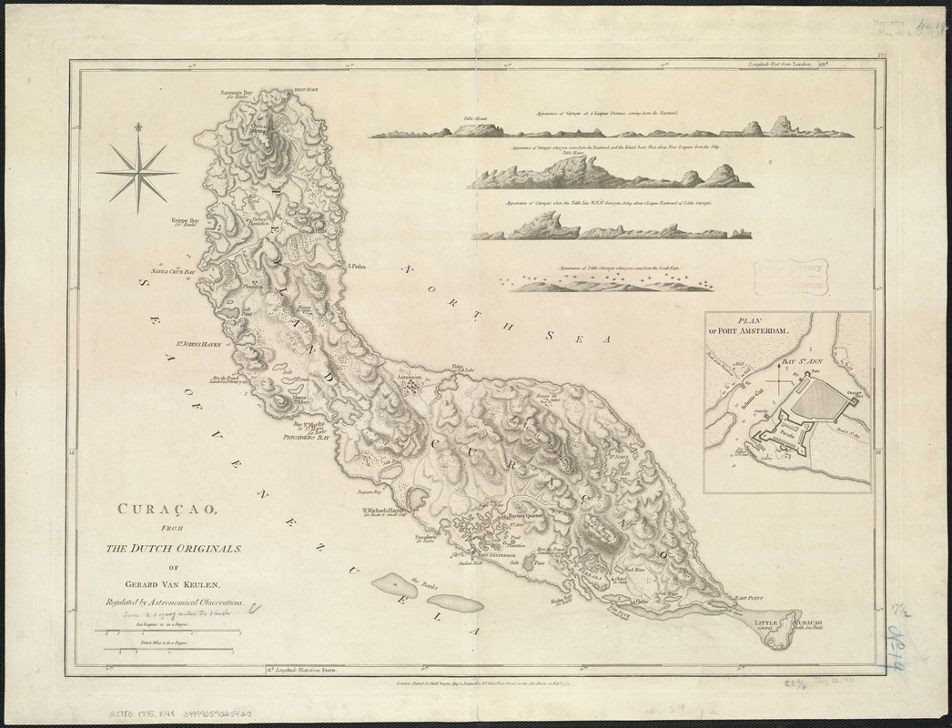
Curaçao
This map is also available in American Revolutionary Geographies Online (ARGO), a collections portal especially built for material relating to the American Revolutionary War Era. Visit ARGO to learn more about this item and explore the historical geography of North America in the late eighteenth century.
Item Information
- Title:
- Curaçao
- Creator:
- Keulen, Gerard van.
- Name on Item:
-
from the Dutch originals, of Gerard van Keulen, regulated by astronomical observations.
- Date:
-
1775
- Format:
-
Maps/Atlases
- Location:
-
Boston Public Library
Norman B. Leventhal Map Center - Collection (local):
-
Norman B. Leventhal Map Center Collection
- Subjects:
-
Curaçao--Maps--Early works to 1800
Willemstad (Curaçao)--Maps--Early works to 1800
- Places:
-
Curacao (territory)Curaçao (island)
Curacao (territory)
Curacao (territory)Curaçao (island)Willemstad
- Extent:
- 1 map ; 45 x 60 cm.
- Terms of Use:
-
No known copyright restrictions.
No known restrictions on use.
- Publisher:
-
London :
Printed for Robt. Sayer
- Scale:
-
Scale [ca. 1:120,000]
- Language:
-
English
- Notes:
-
Relief shown by hachures; depths shown by soundings.
Shows harbors, shoals and banks, plantations, salt pans, ruined houses, wells, anchorages and vegetation.
Includes inset of "Plan of Fort Amsterdam" and relief profiles.
"Printed for Robt. Sayer, Map & Printseller, no. 53 in Fleet Street, as the Act directs 20 Feby. 1775."
Prime meridians: London and Ferro.
Appears in the author's West-India atlas. London : Robert Sayer and John Bennett, 1783 [i.e. 1788].
Cataloging, conservation, and digitization made possible in part by The National Endowment for the Humanities: Exploring the human endeavor.
- Identifier:
-
06_01_006404
- Call #:
-
G5180 1775 .K48
- Barcode:
-
39999059025427