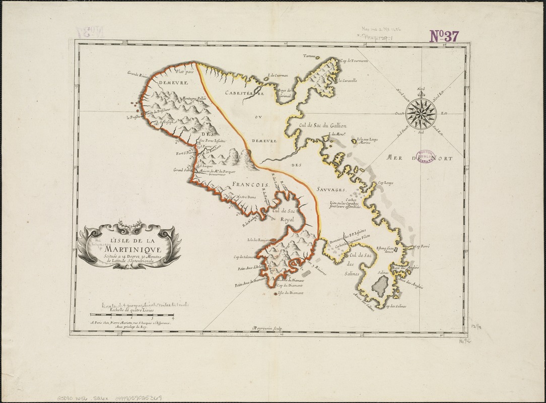
L'isle de la Martinique : scituée a 14 degrez 30 minutes de latitude septentrionale
Item Information
- Title:
- L'isle de la Martinique : scituée a 14 degrez 30 minutes de latitude septentrionale
- Creator:
- Sanson, Nicolas, 1600-1667
- Name on Item:
-
A. Peyrounin sculp.
- Date:
-
[1656?]
- Format:
-
Maps/Atlases
- Location:
-
Boston Public Library
Norman B. Leventhal Map Center - Collection (local):
-
Norman B. Leventhal Map Center Collection
- Subjects:
-
Martinique--Maps--Early works to 1800
- Places:
-
Martinique (territory)
- Extent:
- 1 map : col. ; 31 x 42 cm.
- Terms of Use:
-
No known copyright restrictions.
No known restrictions on use.
- Publisher:
-
A Paris :
Pierre Mariette
- Scale:
-
Scale ca. 1:216,000.
- Language:
-
French
- Notes:
-
Relief shown pictorially.
Cataloging, conservation, and digitization made possible in part by The National Endowment for the Humanities: Exploring the human endeavor.
- Identifier:
-
06_01_006389
- Call #:
-
G5080 1656 .S26x
- Barcode:
-
39999059025369