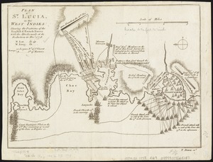
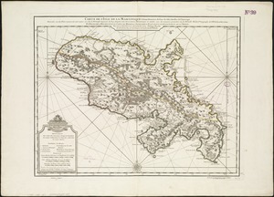
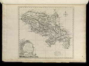
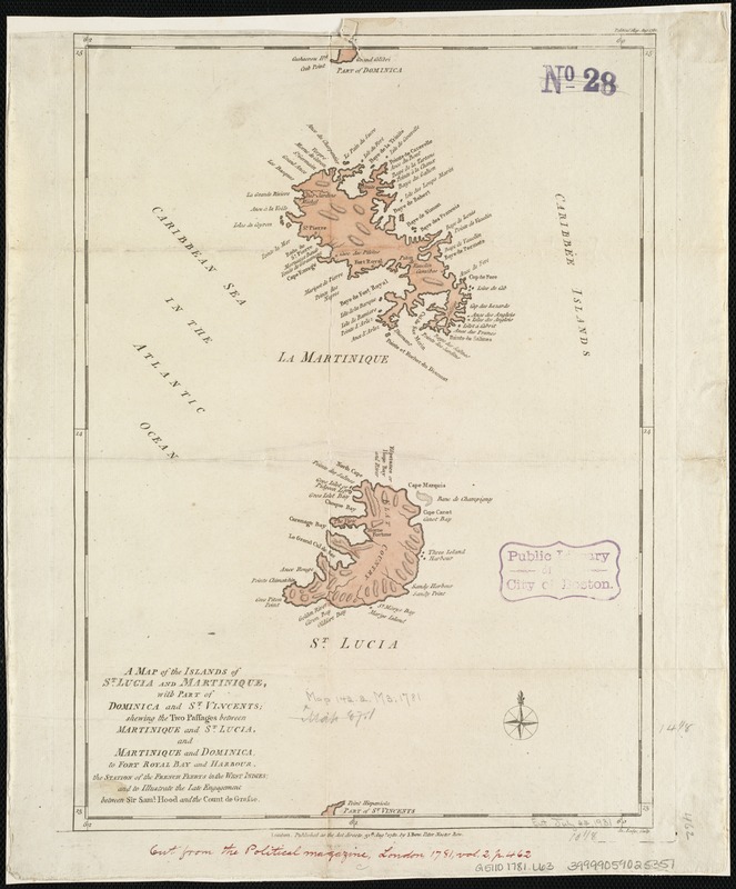
A map of the islands of St. Lucia and Martinique, with part of Dominica and St. Vincents : shewing the two passages between Martinique and St. Lucia, and Martinique and Dominica, to Fort Royal Bay and harbour, the station of the French fleets in the West Indies : and to illustrate the late engagement between Sir Saml. Hood and the Count de Grasse
This map is also available in American Revolutionary Geographies Online (ARGO), a collections portal especially built for material relating to the American Revolutionary War Era. Visit ARGO to learn more about this item and explore the historical geography of North America in the late eighteenth century.
Item Information
- Title:
- A map of the islands of St. Lucia and Martinique, with part of Dominica and St. Vincents : shewing the two passages between Martinique and St. Lucia, and Martinique and Dominica, to Fort Royal Bay and harbour, the station of the French fleets in the West Indies : and to illustrate the late engagement between Sir Saml. Hood and the Count de Grasse
- Creator:
- Lodge, John, d. 1796
- Name on Item:
-
Jn. Lodge sculp.
- Date:
-
1781
- Format:
-
Maps/Atlases
- Location:
-
Boston Public Library
Norman B. Leventhal Map Center - Collection (local):
-
Norman B. Leventhal Map Center Collection
- Subjects:
-
Saint Lucia--Maps--Early works to 1800
Martinique--Maps--Early works to 1800
- Places:
-
Martinique (territory)
Saint Lucia
- Extent:
- 1 map : col. ; 36 x 26 cm.
- Terms of Use:
-
No known copyright restrictions.
No known restrictions on use.
- Publisher:
-
London :
J. Bew
- Scale:
-
Scale not given.
- Language:
-
English
- Notes:
-
Relief shown by hachures.
Cataloging, conservation, and digitization made possible in part by The National Endowment for the Humanities: Exploring the human endeavor.
- Identifier:
-
06_01_006388
- Call #:
-
G5110 1781 .L63
- Barcode:
-
39999059025351