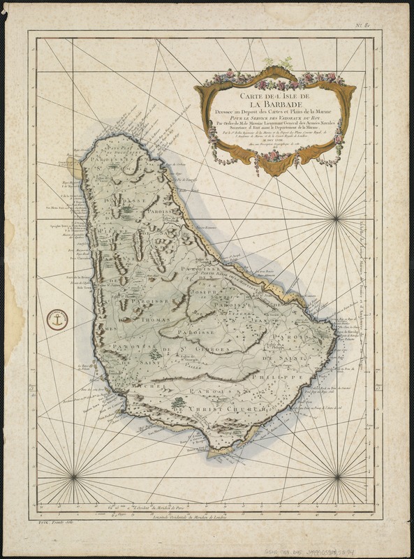
Carte de l'Isle de La Barbade : avec une description geographique de cette isle
This map is also available in American Revolutionary Geographies Online (ARGO), a collections portal especially built for material relating to the American Revolutionary War Era. Visit ARGO to learn more about this item and explore the historical geography of North America in the late eighteenth century.
Item Information
- Title:
- Carte de l'Isle de La Barbade : avec une description geographique de cette isle
- Creator:
- Bellin, Jacques Nicolas, 1703-1772
- Date:
-
[1758]
- Format:
-
Maps/Atlases
- Location:
-
Boston Public Library
Norman B. Leventhal Map Center - Collection (local):
-
Norman B. Leventhal Map Center Collection
- Subjects:
-
Barbados--Maps--Early works to 1800
- Places:
-
Barbados
- Extent:
- 1 map : col. ; 54 x 39 cm.
- Terms of Use:
-
No known copyright restrictions.
No known restrictions on use.
- Publisher:
-
Paris :
Didot
- Scale:
-
Scale [ca. 1:85,000] ;
- Language:
-
French
- Notes:
-
Relief shown by hachures and shading.
Appears in the author's Description Geographique des Isles Antilles possédés par les anglois. No. 7.
"Dressee au depost des cartes et plans de la marine. Pour le service des vaisseaux du roy. Par ordre de M. de Massiac Lieutenant General des Armees Navales..."
Prime meridians: Paris and London.
In upper margin: No. 81.
Cataloging, conservation, and digitization made possible in part by The National Endowment for the Humanities: Exploring the human endeavor.
- Notes (date):
-
This date is inferred.
- Identifier:
-
06_01_006382
- Call #:
-
G5140 1758 .B45
- Barcode:
-
39999059025294


