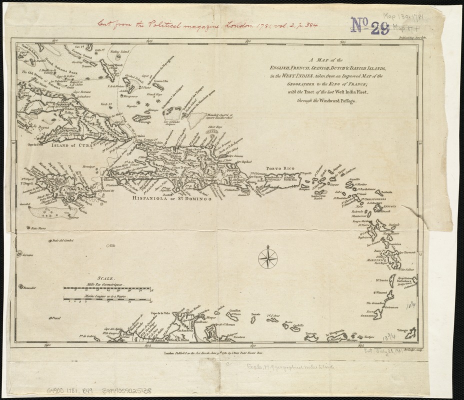
A map of the English, French, Spanish, Dutch, & Danish Islands, in the West Indies, taken from an improved map of the geographer to the King of France, with the tract of the last West India Fleet, through the Windward Passage
This map is also available in American Revolutionary Geographies Online (ARGO), a collections portal especially built for material relating to the American Revolutionary War Era. Visit ARGO to learn more about this item and explore the historical geography of North America in the late eighteenth century.
Item Information
- Title:
- A map of the English, French, Spanish, Dutch, & Danish Islands, in the West Indies, taken from an improved map of the geographer to the King of France, with the tract of the last West India Fleet, through the Windward Passage
- Creator:
- Bew, John, d. 1793
- Date:
-
1781
- Format:
-
Maps/Atlases
- Location:
-
Boston Public Library
Norman B. Leventhal Map Center - Collection (local):
-
Norman B. Leventhal Map Center Collection
- Subjects:
-
West Indies--Maps--Early works to 1800
Great Britain--Colonies--Maps--Early works to 1800
France--Colonies--Maps--Early works to 1800
Spain--Colonies--Maps--Early works to 1800
Netherlands--Colonies--Maps--Early works to 1800
Denmark--Colonies--Maps--Early works to 1800
- Places:
-
West Indies
- Extent:
- 1 map ; 26 x 35 cm.
- Terms of Use:
-
No known copyright restrictions.
No known restrictions on use.
- Publisher:
-
London :
J. Bew
- Scale:
-
Scale ca. 1:4,942,000.
- Language:
-
English
- Notes:
-
Relief shown pictorially.
"Jn. Lodge, Sculp."
Appears in the Political Magazine. June 1781, v.2, p. 384.
Cataloging, conservation, and digitization made possible in part by The National Endowment for the Humanities: Exploring the human endeavor.
- Identifier:
-
06_01_006364
- Call #:
-
G4900 1781 .B49
- Barcode:
-
39999059025138
![[Alleen de Caribische Eilanden, vervat in 't groot]](https://bpldcassets.blob.core.windows.net/derivatives/images/commonwealth:st74cw59p/image_thumbnail_300.jpg)


