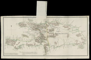
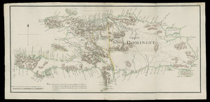
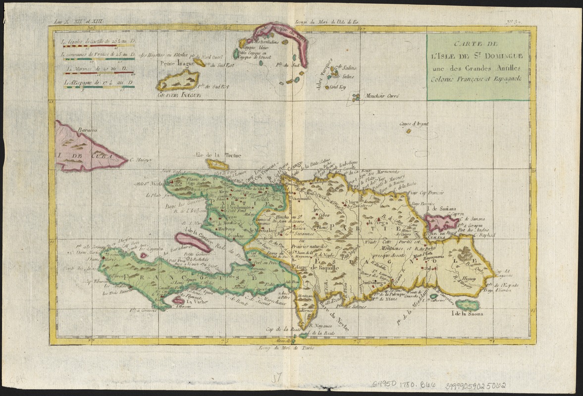
Carte de L'Isle de St. Domingue une des Grandes Antilles, Colonies Francoise et Espagnole
This map is also available in American Revolutionary Geographies Online (ARGO), a collections portal especially built for material relating to the American Revolutionary War Era. Visit ARGO to learn more about this item and explore the historical geography of North America in the late eighteenth century.
Item Information
- Title:
- Carte de L'Isle de St. Domingue une des Grandes Antilles, Colonies Francoise et Espagnole
- Creator:
- Bonne, Rigobert, 1727-1794
- Date:
-
[1780]
- Format:
-
Maps/Atlases
- Location:
-
Boston Public Library
Norman B. Leventhal Map Center - Collection (local):
-
Norman B. Leventhal Map Center Collection
- Subjects:
-
Dominican Republic--Maps--Early works to 1800
Hispaniola--Maps--Early works to 1800
- Places:
-
Dominican Republic
Hispaniola (island)
- Extent:
- 1 map : col. ; 21 x 31 cm.
- Terms of Use:
-
No known copyright restrictions.
No known restrictions on use.
- Publisher:
-
Geneve :
J.L. Pellet
- Scale:
-
Scale [ca. 1:2,400,000]
- Language:
-
French
- Notes:
-
Relief shown pictorially.
Appears in Guillaume-Thomas-François Raynal's Atlas de toutes les parties connues du globe terrestre..."Liv. X.XVII et XIII" ; "No 37". Geneve: J.L. Pellet, 1780.
Prime meridian: Paris and I'sle de Fer.
- Notes (date):
-
This date is inferred.
- Identifier:
-
06_01_006359
- Call #:
-
G4950 1780 .B66
- Barcode:
-
39999059025062