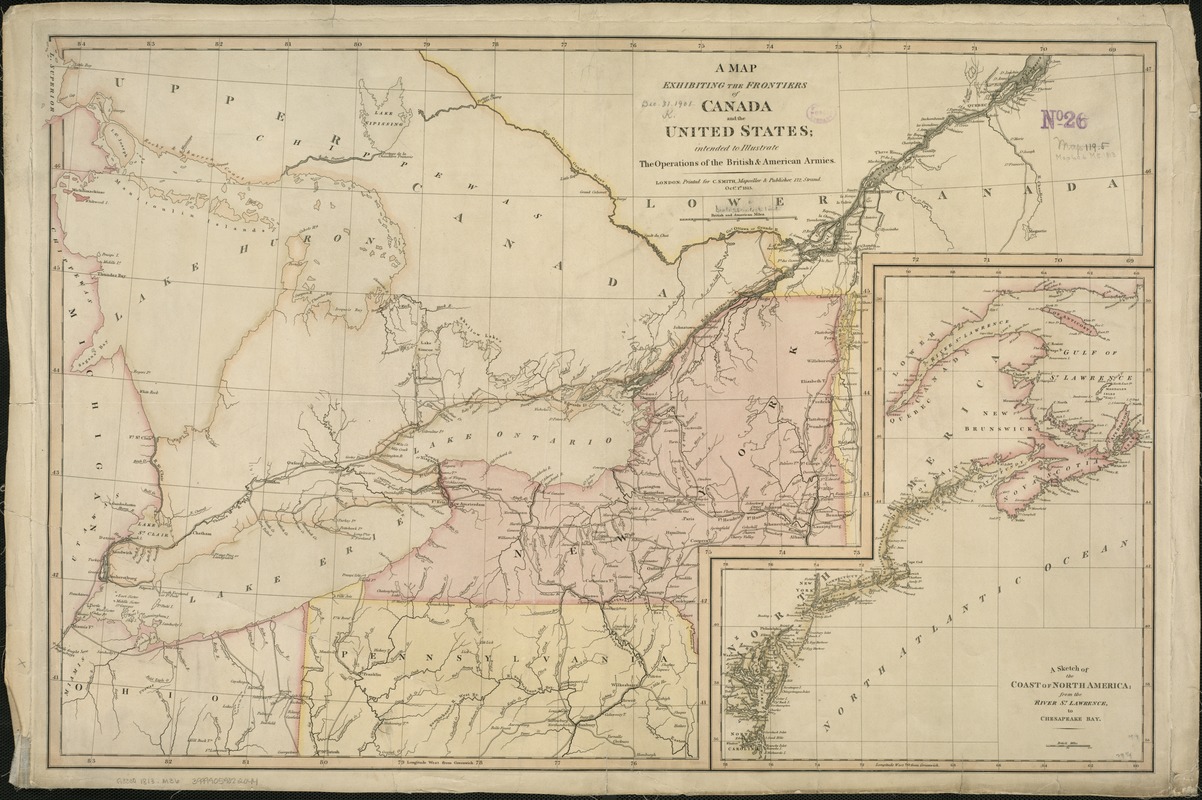
A Map exhibiting the frontiers of Canada and the United States : intended to illustrate the operations of the British & American armies
Item Information
- Title:
- A Map exhibiting the frontiers of Canada and the United States : intended to illustrate the operations of the British & American armies
- Date:
-
1813
- Format:
-
Maps/Atlases
- Location:
-
Boston Public Library
Norman B. Leventhal Map Center - Collection (local):
-
Norman B. Leventhal Map Center Collection
- Subjects:
-
North America--Maps
Canada--Maps
United States--Maps
- Places:
-
North America (area)
United States
Canada
- Extent:
- 1 map : col. ; 50 x 78 cm.
- Terms of Use:
-
No known copyright restrictions.
No known restrictions on use.
- Publisher:
-
London :
Printed for C. Smith
- Scale:
-
Scale 1:1,584,000.
- Language:
-
English
- Notes:
-
Inset: A sketch of the coast of North America; from the River St. Lawrence, to Chesapeake Bay.
- Identifier:
-
06_01_006278
- Call #:
-
G3300 1813 .M36
- Barcode:
-
39999059022044


