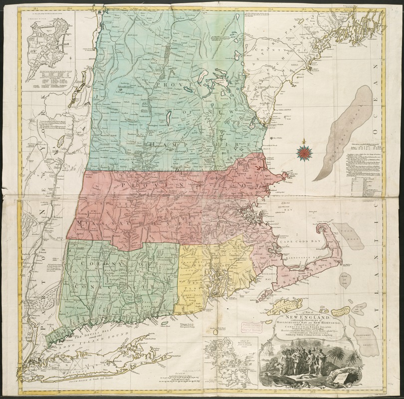
A map of the most inhabited part of New England, containing the provinces of Massachusets Bay and New Hampshire, with the colonies of Connecticut and Rhode Island, divided into counties and townships, the whole composed from actual surveys and its situation adjusted by astronomical observations
This map is also available in American Revolutionary Geographies Online (ARGO), a collections portal especially built for material relating to the American Revolutionary War Era. Visit ARGO to learn more about this item and explore the historical geography of North America in the late eighteenth century.
Item Information
- Title:
- A map of the most inhabited part of New England, containing the provinces of Massachusets Bay and New Hampshire, with the colonies of Connecticut and Rhode Island, divided into counties and townships, the whole composed from actual surveys and its situation adjusted by astronomical observations
- Creator:
- Lotter, Tobias Conrad, 1717-1777
- Date:
-
[1776]
- Format:
-
Maps/Atlases
- Location:
-
Boston Public Library
Norman B. Leventhal Map Center - Collection (local):
-
Norman B. Leventhal Map Center Collection
- Subjects:
-
New England--Maps--Early works to 1800
- Places:
-
New England (area)
- Extent:
- 1 map : col. ; 102 x 98 cm.
- Terms of Use:
-
No known copyright restrictions.
No known restrictions on use.
- Publisher:
-
Augsburg :
T.C. Lotter
- Scale:
-
Scale ca. 1:450,000.
- Language:
-
English
- Notes:
-
Relief shown pictorially.
Hand colored.
Prime meridian: London and Ferro.
Includes compilation data and insets of "A plan of the town of Boston" and "A plan of Boston Harbor from an accurate survey," ca. 1:150,000.
- Notes (date):
-
This date is inferred.
- Identifier:
-
06_01_006277
- Call #:
-
G3720 1776 .L67
- Barcode:
-
39999059022036
- LCCN:
-
74692166


