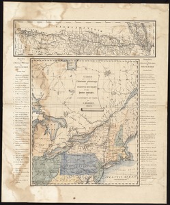
A new map of part of the United States of North America, containing those of New York, Vermont, New Hampshire, Massachusets [sic], Connecticut, Rhode Island, Pennsylvania, New Jersey, Delaware, Maryland and Virginia : from the latest authorities
![A new map of part of the United States of North America, containing those of New York, Vermont, New Hampshire, Massachusets [sic], Connecticut, Rhode Island, Pennsylvania, New Jersey, Delaware, Maryland and Virginia](https://bpldcassets.blob.core.windows.net/derivatives/images/commonwealth:6t053p06v/image_access_800.jpg)
Item Information
- Title:
- A new map of part of the United States of North America, containing those of New York, Vermont, New Hampshire, Massachusets [sic], Connecticut, Rhode Island, Pennsylvania, New Jersey, Delaware, Maryland and Virginia : from the latest authorities
- Creator:
- Cary, John, ca. 1754-1835
- Name on Item:
-
by John Cary.
- Date:
-
1806
- Format:
-
Maps/Atlases
- Location:
-
Boston Public Library
Norman B. Leventhal Map Center - Collection (local):
-
Norman B. Leventhal Map Center Collection
- Subjects:
-
Northeastern States--Maps
- Places:
-
Northeastern United States (area)
- Extent:
- 1 map : col. ; 44 x 50 cm.
- Terms of Use:
-
No known copyright restrictions.
No known restrictions on use.
- Publisher:
-
London :
J. Cary
- Scale:
-
Scale ca. 1:2,750,000.
- Language:
-
English
- Notes:
-
Relief shown by hachures.
Includes navigational and vegetational notes.
- Identifier:
-
06_01_006259
- Call #:
-
G3710 1806 .C37
- Barcode:
-
39999059021806