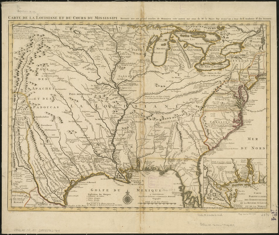
Carte de la Louisiane et du cours de Mississipi
Item Information
- Title:
- Carte de la Louisiane et du cours de Mississipi
- Creator:
- L'Isle, Guillaume de, 1675-1726
- Name on Item:
-
dressée sur un grand nombre de memoires entr'autres sur ceux de Mr. le Maire, par Guillme. de L'Isle.
- Date:
-
[1718?]
- Format:
-
Maps/Atlases
- Location:
-
Boston Public Library
Norman B. Leventhal Map Center - Collection (local):
-
Norman B. Leventhal Map Center Collection
- Subjects:
-
Louisiana--Maps--Early works to 1800
Mississippi River Valley--Maps--Early works to 1800
United States--Maps--Early works to 1800
1718
- Places:
-
Mississippi River
Louisiana
- Extent:
- 1 map : col. ; 42 x 59 cm.
- Terms of Use:
-
No known copyright restrictions.
No known restrictions on use.
- Publisher:
-
Amsterdam :
J. Covens et C. Mortier
- Scale:
-
Scale ca. 1:4,752,000.
- Language:
-
French
- Notes:
-
Relief shown pictorially.
Bar graph (33/8") "Echelle de cent lievres Francoises."
Hand colored.
Inset: Carte particuliere des embouchures de la riviere S. Louis et de la Mobile. Scale ca. 1:2,376,000.
- Identifier:
-
06_01_006255
- Call #:
-
G4042.M5 1718 .L57
- Barcode:
-
39999059021764


