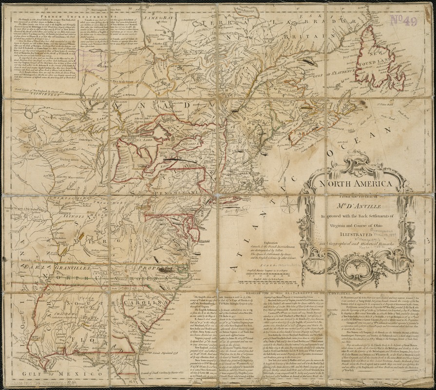
North America from the French of Mr. D'Anville, improved with the back settlements of Virginia and course of Ohio, illustrated with geographical and historical remarks
This map is also available in American Revolutionary Geographies Online (ARGO), a collections portal especially built for material relating to the American Revolutionary War Era. Visit ARGO to learn more about this item and explore the historical geography of North America in the late eighteenth century.
Item Information
- Title:
- North America from the French of Mr. D'Anville, improved with the back settlements of Virginia and course of Ohio, illustrated with geographical and historical remarks
- Creator:
- Jefferys, Thomas, d. 1771
- Date:
-
1755
- Format:
-
Maps/Atlases
- Location:
-
Boston Public Library
Norman B. Leventhal Map Center - Collection (local):
-
Norman B. Leventhal Map Center Collection
- Subjects:
-
North America--Maps--Early works to 1800
Great Britain--Colonies--America--Maps--Early works to 1800
France--Colonies--America--Maps--Early works to 1800
- Places:
-
North America (area)
- Extent:
- 1 map : hand col. ; 47 x 51 cm.
- Terms of Use:
-
No known copyright restrictions.
No known restrictions on use.
- Publisher:
-
[London] :
Thos. Jefferys
- Scale:
-
Scale [ca. 1:6,500,000]
- Language:
-
English
- Notes:
-
Relief shown pictorially.
Original issue.
Shows the East coast from Labrador to northern Florida, and the interior as far west as the Mississippi Valley.
Prime meridians: Ferro and London.
Includes text: French incroachments [2 col.] -- English title to their settlements on the continent [3 col.].
- Identifier:
-
06_01_006250
- Call #:
-
G3300 1755 .J4
- Barcode:
-
39999059021699


