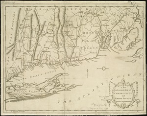
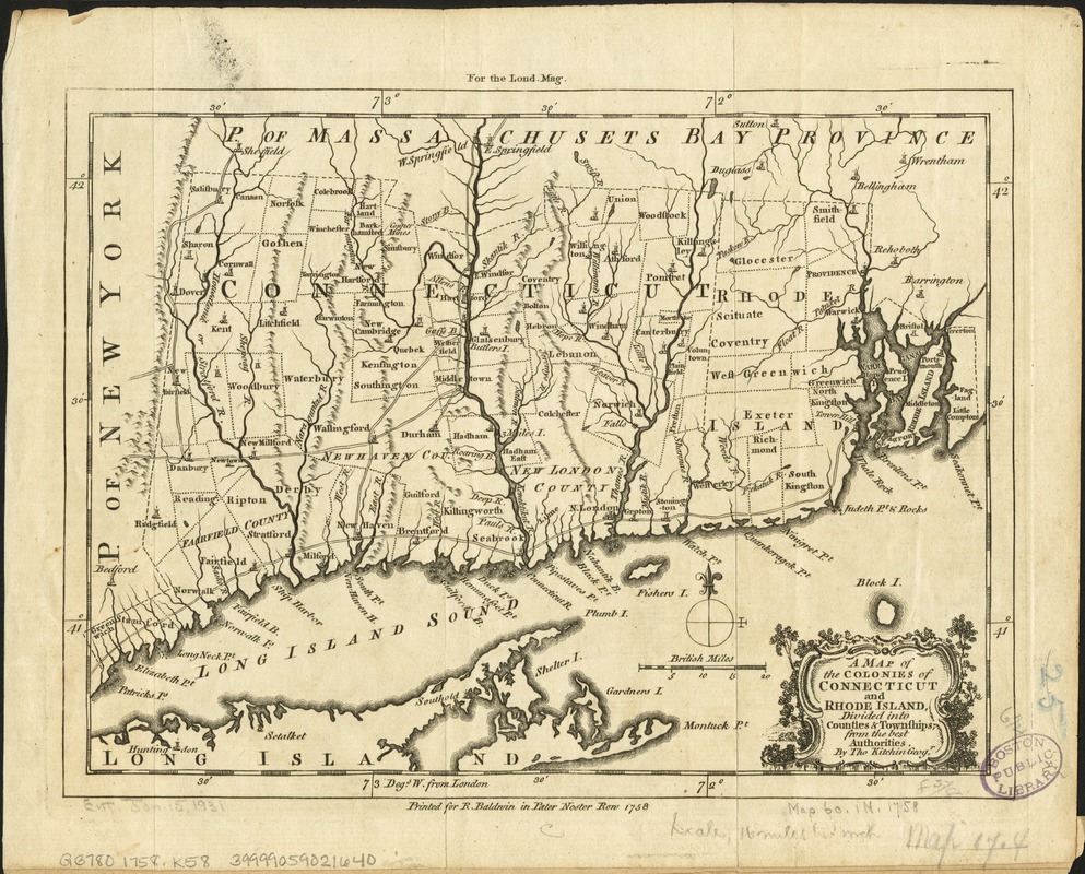
A map of the colonies of Connecticut and Rhode Island, divided into counties & townships, from the best authorities
This map is also available in American Revolutionary Geographies Online (ARGO), a collections portal especially built for material relating to the American Revolutionary War Era. Visit ARGO to learn more about this item and explore the historical geography of North America in the late eighteenth century.
Item Information
- Title:
- A map of the colonies of Connecticut and Rhode Island, divided into counties & townships, from the best authorities
- Creator:
- Kitchin, Thomas, d. 1784
- Name on Item:
-
by Tho. Kitchin, geog'r.
- Date:
-
1758
- Format:
-
Maps/Atlases
- Location:
-
Boston Public Library
Norman B. Leventhal Map Center - Collection (local):
-
Norman B. Leventhal Map Center Collection
- Subjects:
-
Connecticut--Maps--Early works to 1800
Rhode Island--Maps--Early works to 1800
- Places:
-
Rhode Island
Connecticut
- Extent:
- 1 map ; 16 x 22 cm.
- Terms of Use:
-
No known copyright restrictions.
No known restrictions on use.
- Publisher:
-
[London] :
Printed for R. Baldwin
- Scale:
-
Scale [ca. 1:1,045,440]
- Language:
-
English
- Notes:
-
Relief shown pictorially.
"For the Lond. Mag."--Upper margin.
Prime meridian: London.
- Identifier:
-
06_01_006232
- Call #:
-
G3780 1758 .K58
- Barcode:
-
39999059021640