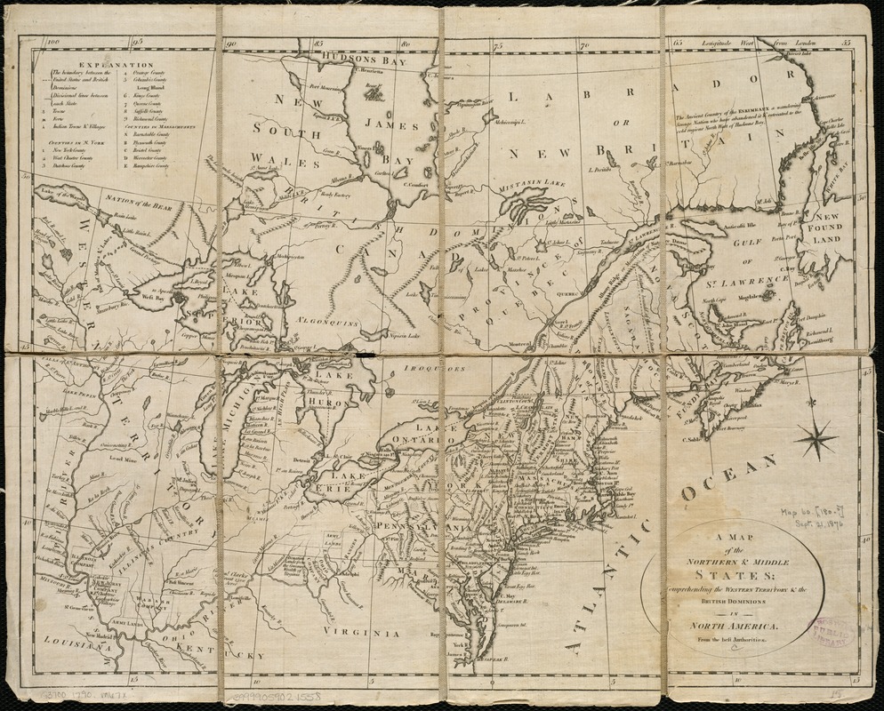
A map of the northern and middle states : comprehending the western territory & the British dominions in North America : from the best authorities
This map is also available in American Revolutionary Geographies Online (ARGO), a collections portal especially built for material relating to the American Revolutionary War Era. Visit ARGO to learn more about this item and explore the historical geography of North America in the late eighteenth century.
Item Information
- Title:
- A map of the northern and middle states : comprehending the western territory & the British dominions in North America : from the best authorities
- Creator:
- Morse, Jedidiah, 1761-1826
- Date:
-
[ca. 1790]
- Format:
-
Maps/Atlases
- Location:
-
Boston Public Library
Norman B. Leventhal Map Center - Collection (local):
-
Norman B. Leventhal Map Center Collection
- Subjects:
-
United States--Maps--Early works to 1800
North America--Maps--Early works to 1800
- Places:
-
North America (area)
- Extent:
- 1 map ; 30 x 39 cm.
- Terms of Use:
-
No known copyright restrictions.
No known restrictions on use.
- Publisher:
-
S.l :
s.n.
- Scale:
-
Scale not given.
- Language:
-
English
- Notes:
-
Relief shown pictorially.
Includes index.
- Identifier:
-
06_01_006225
- Call #:
-
G3700 1790 .M67
- Barcode:
-
39999059021558


