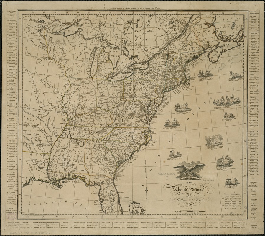
An improved map of the United States
Item Information
- Title:
- An improved map of the United States
- Creator:
- Shelton & Kensett
- Name on Item:
-
by Shelton & Kensett.
- Date:
-
1813
- Format:
-
Maps/Atlases
- Location:
-
Boston Public Library
Norman B. Leventhal Map Center - Collection (local):
-
Norman B. Leventhal Map Center Collection
- Subjects:
-
United States--Maps
United States--History--War of 1812--Maps
- Places:
-
- Extent:
- 1 map : col. ; 51 x 62 cm.
- Terms of Use:
-
No known copyright restrictions.
No known restrictions on use.
- Publisher:
-
Cheshire, Conn :
Shelton & Kensett
- Scale:
-
Scale [ca. 1:6,000,000].
- Language:
-
English
- Notes:
-
Relief shown pictorially.
Includes 10 vignettes of naval battles of the War of 1812.
"Copyright secured & entered according to Act of Congress July 6th, 1813."
"Engraved by A. Doolittle New Haven AE 60", partially obliterated in the plate.
Longitude in degrees east and west from Washington, D.C.; latitude in degrees north from the equator.
States and territories outlined in color.
Includes tables of distances, populations and products of states in margins.
- Identifier:
-
06_01_006224
- Call #:
-
G3700 1813 .S54
- Barcode:
-
39999059021541


