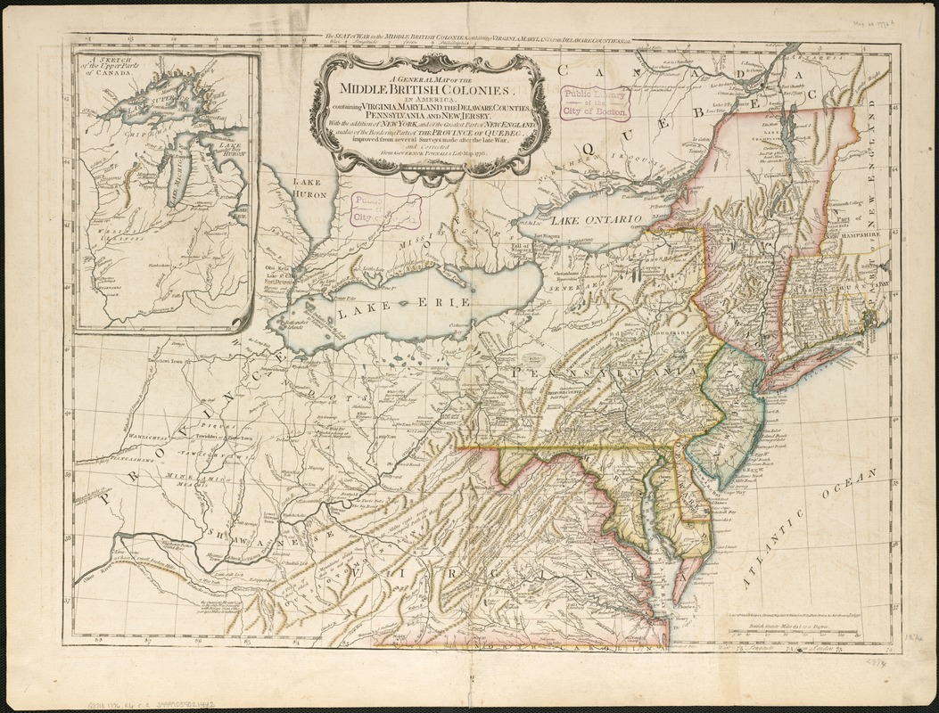
A general map of the middle British colonies, in America : containing Virginia, Maryland, the Delaware counties, Pennsylvania and New Jersey : with the addition of New York, and the greatest part of New England, as also of the bordering parts of the province of Quebec, improved from several surveys made after the late war, and corrected from Governor Pownall's late map 1776
This map is also available in American Revolutionary Geographies Online (ARGO), a collections portal especially built for material relating to the American Revolutionary War Era. Visit ARGO to learn more about this item and explore the historical geography of North America in the late eighteenth century.
Item Information
- Title:
- A general map of the middle British colonies, in America : containing Virginia, Maryland, the Delaware counties, Pennsylvania and New Jersey : with the addition of New York, and the greatest part of New England, as also of the bordering parts of the province of Quebec, improved from several surveys made after the late war, and corrected from Governor Pownall's late map 1776
- Title (alt.):
-
Seat of the war in the middle British colonies, containing Virginia, Maryland, the Delaware counties, &ca
- Creator:
- Robert Sayer and John Bennett (Firm)
- Date:
-
1776
- Format:
-
Maps/Atlases
- Location:
-
Boston Public Library
Norman B. Leventhal Map Center - Collection (local):
-
Norman B. Leventhal Map Center Collection
- Subjects:
-
Northeastern States--History--Revolution, 1775-1783--Maps--Early works to 1800
- Places:
-
Northeastern United States (area)
- Extent:
- 1 map : hand col ; 49 x 66 cm.
- Terms of Use:
-
No known copyright restrictions.
No known restrictions on use.
- Publisher:
-
London :
Printed for R. Sayer & J. Bennett
- Scale:
-
Scale [ca. 1:2,300,000]
- Language:
-
English
- Notes:
-
Relief shown pictorially.
Prime meridians: Philadelphia and London.
Inset: A sketch of the upper parts of Canada.
In The American military pocket atlas (London : R. Sayer and J Bennet, [1776]), pl. 4.
- Identifier:
-
06_01_006218
- Call #:
-
G3710 1776 .R6
- Barcode:
-
39999059021442


