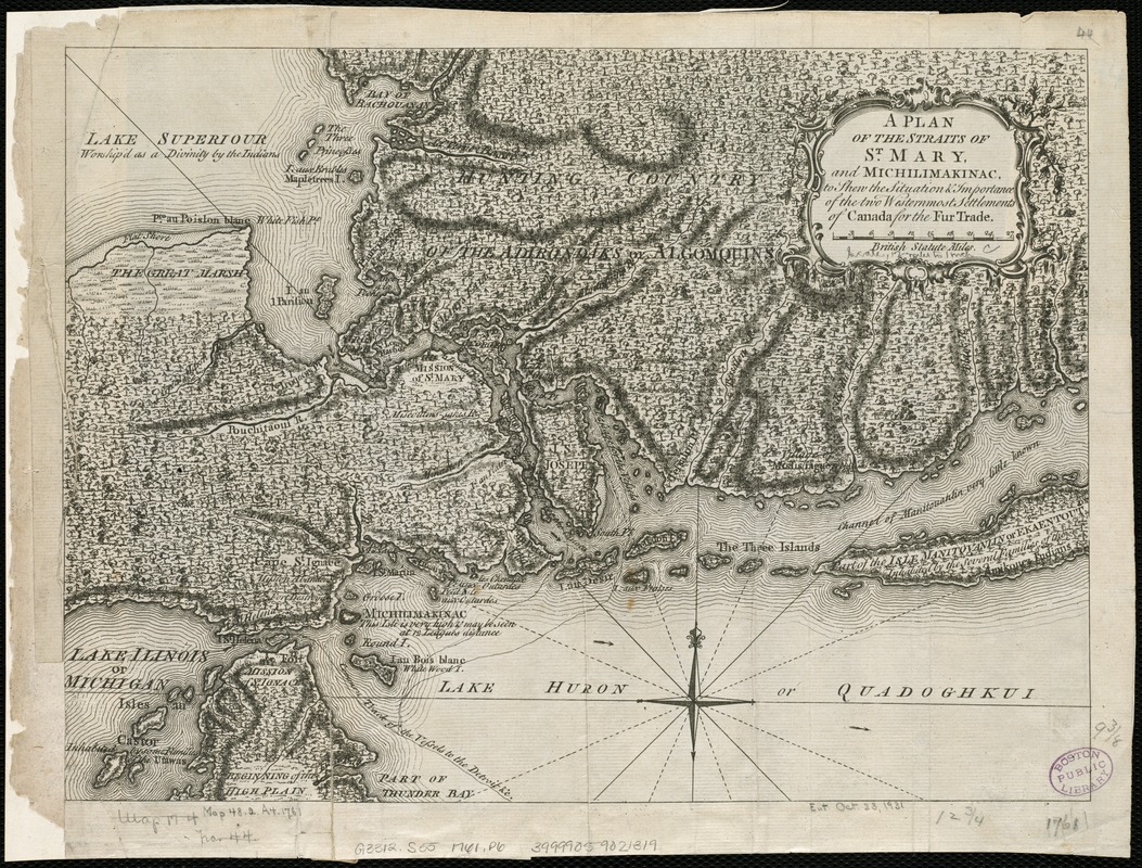
A plan of the Straits of St. Mary, and Michilimakinac, to shew the situation & importance of the two westernmost settlements of Canada for the fur trade
This map is also available in American Revolutionary Geographies Online (ARGO), a collections portal especially built for material relating to the American Revolutionary War Era. Visit ARGO to learn more about this item and explore the historical geography of North America in the late eighteenth century.
Item Information
- Title:
- A plan of the Straits of St. Mary, and Michilimakinac, to shew the situation & importance of the two westernmost settlements of Canada for the fur trade
- Date:
-
[1761]
- Format:
-
Maps/Atlases
- Location:
-
Boston Public Library
Norman B. Leventhal Map Center - Collection (local):
-
Norman B. Leventhal Map Center Collection
- Subjects:
-
Indians of North America--Saint Marys River (Mich. and Ont.)--Maps--Early works to 1800
Saint Marys River (Mich. and Ont.)--Maps--Early works to 1800
Mackinac, Straits of (Mich.)--Maps--Early works to 1800
- Places:
-
Chippewa (county)Saint Marys River
Straits of Mackinac
- Extent:
- 1 map ; 24 x 33 cm.
- Terms of Use:
-
No known copyright restrictions.
No known restrictions on use.
- Publisher:
-
London :
London Magazine
- Scale:
-
Scale [ca. 1:760,000]
- Language:
-
English
- Notes:
-
Relief shown by hachures.
Removed from: London magazine. Vol. 30 (1761), opp. p. 84.
Cataloging, conservation, and digitization made possible in part by The National Endowment for the Humanities: Exploring the human endeavor.
- Notes (date):
-
This date is inferred.
- Identifier:
-
06_01_006205
- Call #:
-
G3312.S55 1761 .P6
- Barcode:
-
39999059021319